
There are 75 counties in Arkansas – “The Natural State“
Also be sure to see my United States County Counting Page for the rest of the states.
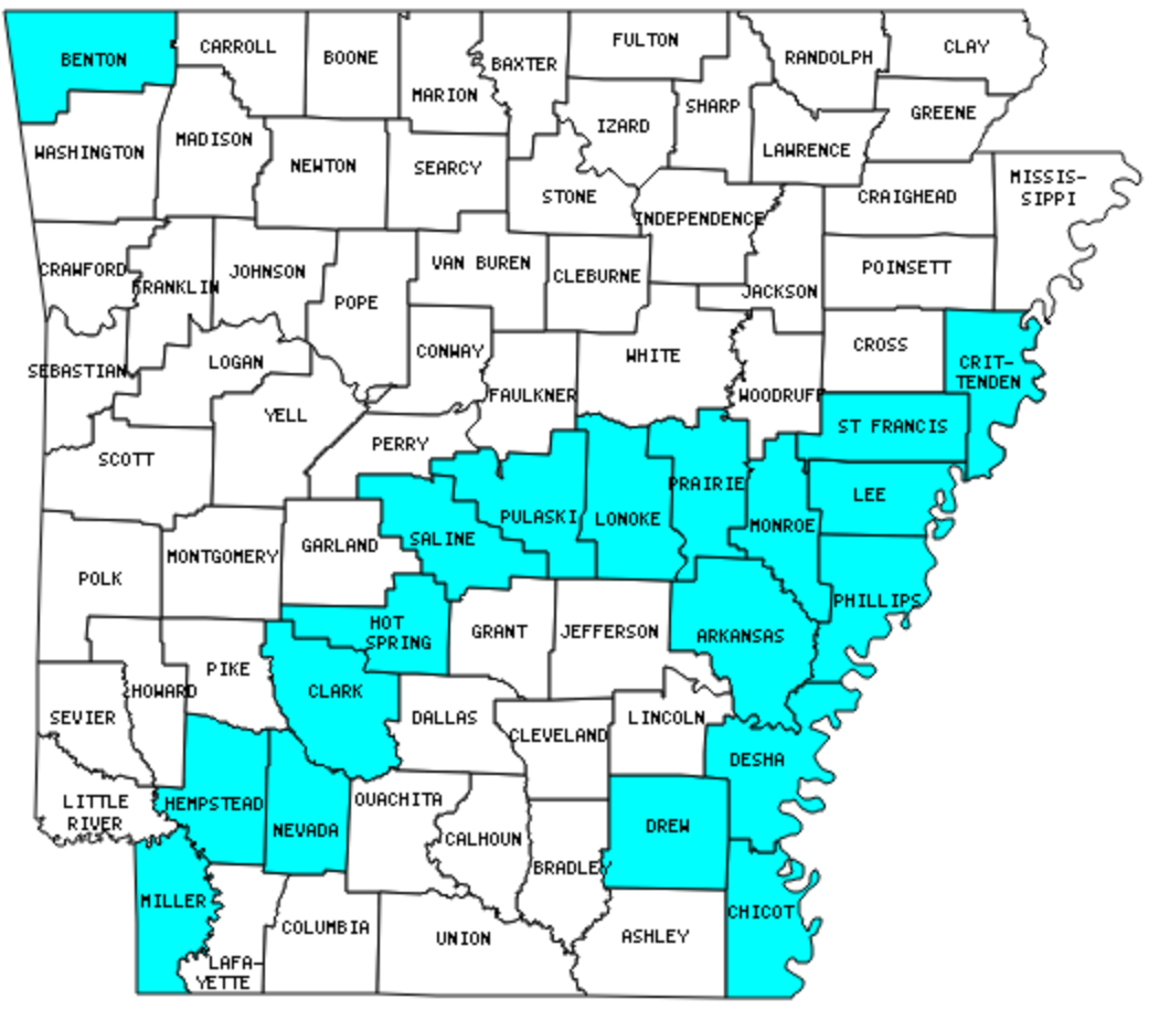
I have visited 19 Counties = 25.3% of Counties in Arkansas
Counties visited are colored-in; counties still needing to be visited are blank. Map created using Mob Rule.
Twelve Mile Circle Articles Featuring Places in Arkansas
Markers designate the Arkansas locations featured in Twelve Mile Circle articles.
Counties in Arkansas
Below are the 75 counties in Arkansas. Although infrequent, counties sometimes do change so please let me know if any of this information is out of date and I will update it. Those counties that I have visited are highlighted in Red. Readers can also link to any articles manually in this section if the map isn’t working.
- Arkansas: Arkansas Post
- Ashley: Ouachita River
- Baxter
- Benton: Pea Ridge Military Park
- Boone
- Bradley
- Calhoun: Smallest county population in Arkansas (5,744 people in 2000 Census).
- Carroll
- Chicot: Lake Chicot Park; Greenville Bridge
- Clark: Arkadelphia
- Clay
- Cleburne
- Cleveland
- Columbia
- Conway
- Craighead
- Crawford
- Crittenden: Hernando DeSoto Bridge
- Cross
- Dallas
- Desha: Tire Man
- Drew
- Faulkner
- Franklin
- Fulton
- Garland: Bathhouse Row; Mirlo Lane
- Grant
- Greene
- Hempstead: Presidential Birthplaces
- Hot Spring
- Howard
- Independence
- Izard
- Jackson
- Jefferson
- Johnson
- Lafayette: Smallest county in Arksansas (527 square miles).
- Lawrence
- Lee
- Lincoln
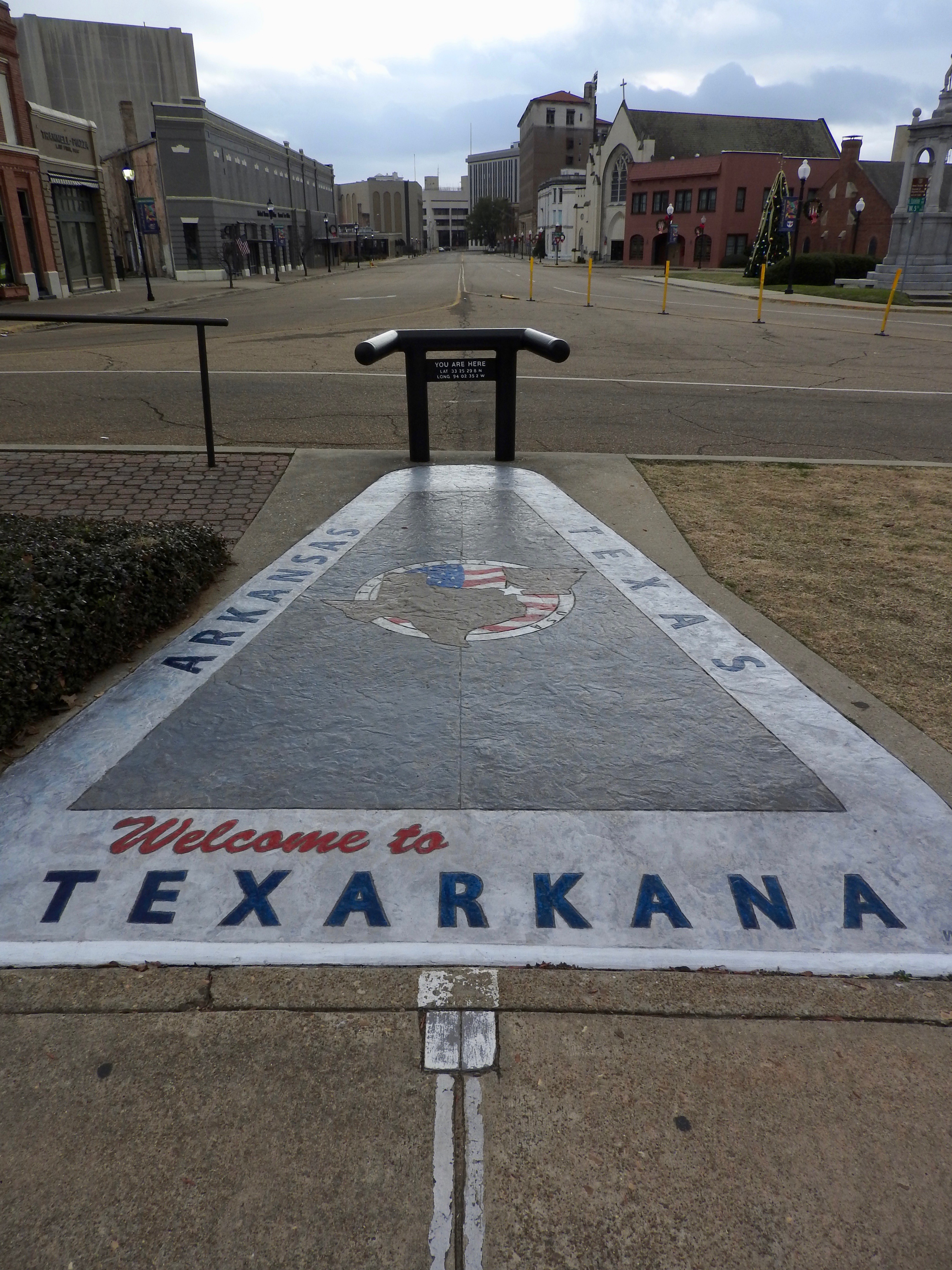
- Little River
- Logan
- Lonoke
- Madison
- Marion: Turkey
- Miller: Cross-Country; Bordersplit; In Them Old Cotton Fields; Smokey and the Bandit Route
- Mississippi
- Monroe: Louisiana Purchase State Park
- Montgomery
- Nevada: County with (Another) State’s Name
- Newton
- Ouachita
- Perry: Nimrod Lake; Stair-Step Border
- Phillips
- Pike: Crater of Diamonds
- Poinsett: Weiner Cutoff Road
- Polk: Shaped Like it Sounds
- Pope
- Prairie
- Pulaski: Largest county population in Arkansas (361,474 people in 2000 Census); Sweet Home.
- Randolph
- Saline
- Scott
- Searcy
- Sebastian
- Sevier
- Sharp
- St. Francis
- Stone
- Union: Largest county in Arkansas (1,039 square miles); Adjacent Counties, Same Name, Different States; Ouachita River
- Van Buren
- Washington
- White
- Woodruff
- Yell: Stair-Step Border; Nimrod Lake
Quick Facts About Arkansas
- Location: West South Central United States. See map above.
- Size(1): 52,035 square miles. Arkansas is the 27th largest state. The next larger state is Florida and the next smaller state is Alabama.
- Population(2): 3,023,825 people. Arkansas is the 33rd most populous state. The next more populous state is Nevada next less populous state is Mississippi.
- Population Density: 58.1 people per square mile. Arkansas is the 34th most densely populated state. The next more densely populated state is Arizona and the next less densely populated state is Oklahoma.
- Bordering States: Arkansas shares a border with 6 states: Missouri, Oklahoma, Texas, Louisiana, Mississippi and Tennessee.
- Admission to the Union: June 15, 1836. Arkansas was the 25th state admitted to the Union, after Missouri and before Michigan.
- Capital: Little Rock.
- Highest Point: 2,753 feet at Signal Hill (part of Magazine Mountain). See SummitPost’s Mount Magazine-Signal Hill page.
- Lowest Point: 55 feet along the Ouachita River in Ashley/Union Counties.
- Government website: Arkansas.gov: The Official Website for the State of Arkansas.
- Official Tourism website: Arkansas Tourism.
- Still not enough? See Wikipedia’s Arkansas page.
Sources:
(1) Wikipedia: List of U.S. states and territories by area. Land area only.
(2) Wikipedia: List of states and territories of the United States by population. Estimated population on July 1, 2019.
Leave a Reply