
Homer, Kenai Peninsula Borough, Alaska, USA (July 2010)
We drove along the Sterling Highway, curving south and passing towns like Clam Gulch, Ninilchik, and Anchor Point, heading ever further down the Kenai Peninsula until we could drive no further. We arrived in Homer and headed towards the famous Homer Spit. Part of the appeal, naturally, is that this is literally the end of the road (map). Anyone wanting to go any further will have to head towards the ferry terminal and continue by sea.
The Homer Spit is such an odd phenomenon geographically. Surrounding mainland terrain is hilly but the spit itself isn’t much more than a sandbar, albeit an awesome sandbar that stretches four and a half miles into Kachemak Bay. Nobody is certain exactly how it formed, whether by complex tidal currents or by ancient retreating glaciers. Either way it seems completely out of place, sticking out into the sea like a thumb amid the rugged terrain.
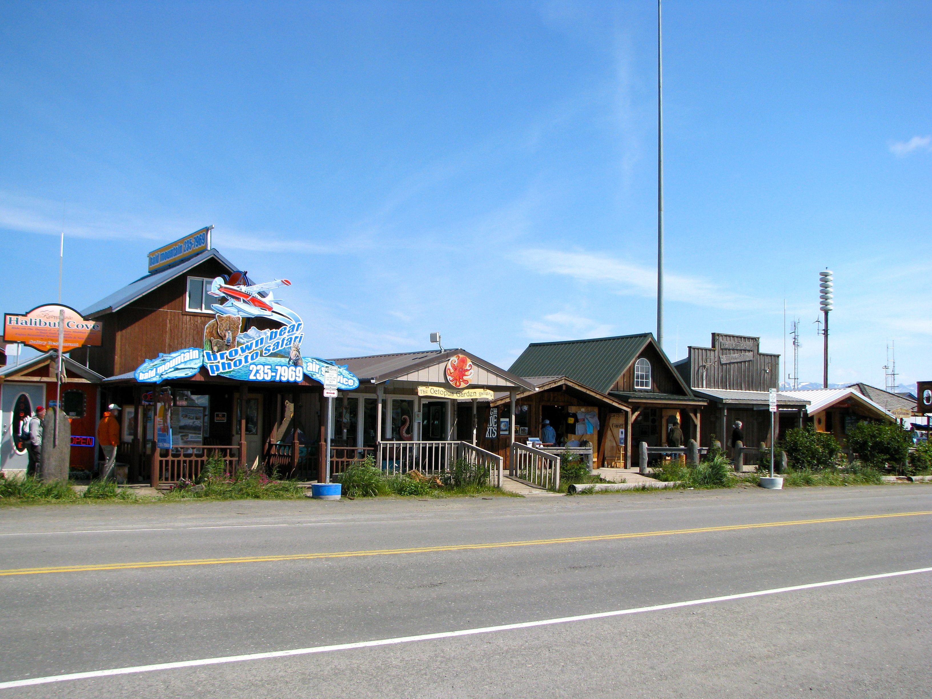
It also doesn’t feel like the rest of Alaska. Certainly it has Alaskan elements but it also seems to have a lot in common with boardwalk towns along the coasts of the Lower 48 with a typical array of tourist spots and crowds milling about. We visited in July and it was the only place along the Kenai Peninsula where we ever had trouble finding parking. Even Anchorage had a better parking situation. Nonetheless we did find a spot eventually and pumped a few dollars into the local economy as we walked among the conglomeration of shops near the tip of the spit.
Salty Dawg Saloon

The Salty Dawg is probably the most noteworthy landmark. This rustic saloon is composed of vintage Homer buildings from the turn of the last century cobbled together into a single structure. It’s been around in one form or another since the 1950’s. However the lighthouse if fake. It’s used to cover a water tank but it’s realistic enough to fool many of the tourists who happily snapped photos.
Incredible Tides

Homer and other areas on the Kenai Peninsula can have extreme tides, as much as 28 feet between the highest and lowest tides and a mean average difference of nearly 16 feet. The Homer Boat Harbor near the tip of the spit has to take this into consideration. We visited right at low tide totally by coincidence. Notice the height of the poles anchoring the floating piers so they can rise and fall with the waters.
Also notice the downward angle of the stairwell leading down to the docks. The tides don’t generally raise boats all the way to the top — the poles show clear marks where the water generally rises — but they need to be tall enough to handle even the most extreme cases. We watched the tide start to rush back in and it was an amazingly powerful sight.
Dangerous Waters
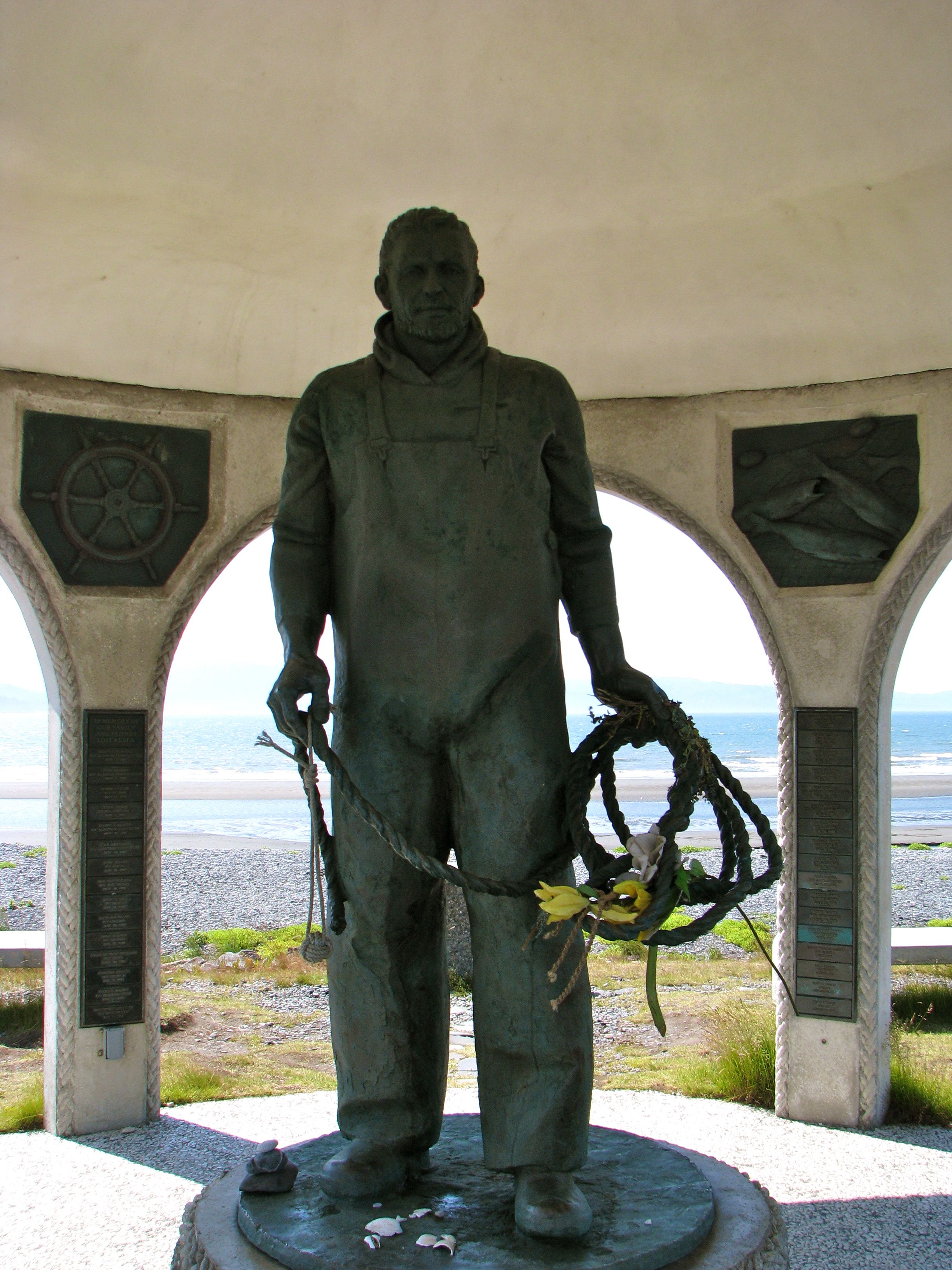
It’s not all lighthearted and touristy on the Spit. Commercial fishing vessels also use the boat harbor and they have a much longer history here than the summertime interlopers. The “Time Bandit” of the reality show Deadliest Catch uses Homer as its home base, and even had a shop along the spit when we were visiting. It’s a dangerous profession. The citizens of Homer have erected the Seafarer’s Memorial to remember those who went out onto the waters and never returned.
Leave a Reply