
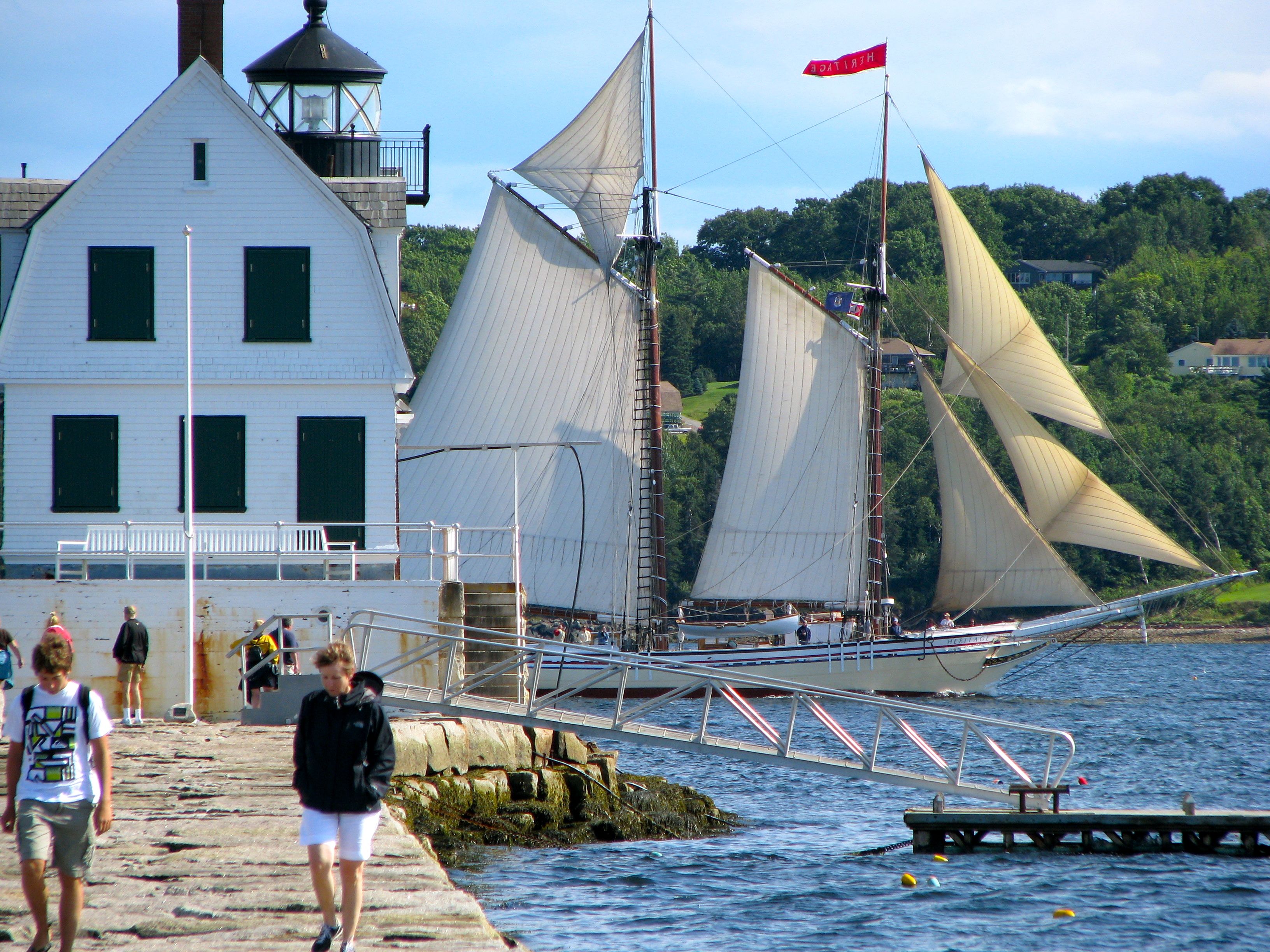
Rockland Harbor, Maine (August 2009)
A breakwater stretches along the mouth of Rockland Harbor providing refuge from storms and pounding surf. A lighthouse rests atop that long wall of rock assuring that no harm comes to mariners as they negotiate their way into the harbor. It’s easy to find the lighthouse. Visitors merely need to head north out of Rockland on Route 1 – Camden Street, turn right on Waldo Avenue, then turn right on Samoset Road, hugging the curve of the harbor the entire time until it ends (map). There’s plenty of parking.
Then a more difficult phase begins. Visitors need to walk a well-worn path to the base of the breakwater, then march 7/8 of a mile straight out to sea along the large granite blocks to the lighthouse. It’s level and not particularly strenuous but it’s not sidewalk smooth either. It would be easy enough to twist an ankle should someone not pay attention or focus on the views rather than the path. People could stop along the way and take stock of the scenery though. That would be safer and much more rewarding. Take time and relax.
The Lighthouse

The Rockland waterfront once sat exposed to nor’easters that periodically racked the coast. Townspeople finally had enough of the repetitious storm damage and began petitioning for a breakwater during the latter half of the Nineteenth Century. Relief finally came in 1880 with the approval of a breakwater but this caused another problem: a solid stone wall jutting nearly a mile across the mouth of the harbor became a mighty significant navigational hazard too. Builders placed temporary beacons upon the end of the breakwater as construction progressed further into the harbor. Finally a lighthouse arose on the completed structure in 1902, with a fourth order Fresnel lens marking the entrance.
Lighthouse keepers manned the station until the 1960’s upon its automation. The Samoset Resort handled maintenance beginning in 1973. Then ownership conveyed to the City of Rockland in 1998 as part of the Maine Lights Program. Now the Friends of the Rockland Breakwater Lighthouse care for the structure on the City’s behalf, intending to restore it to its original condition. The actual breakwater continues to be owned and maintained by the U.S. Army Corps of Engineers.
The National Register of Historic Places added the lighthouse to its list in 1981.
Keeper’s Quarters
The Keepers Quarters featured several rooms on two stories, a cozy little space in the middle of Rockland Harbor accessible to land via the breakwater or a short rowboat ride. Keepers here did not experience the same sense of isolation as those manning other lighthouses along the American coastlines. It must have been a pretty nice posting for someone serving in the U.S. Lighthouse Service, all things considered.
However the structure fell into disrepair after automation without anyone around to maintain it every day. This exposed location takes a beating in the harsh Maine winters. Decay nearly ruined it by the time the Friends of the Rockland Breakwater Lighthouse formed in 1999. They have been slowly restoring the structure as time and funds permit, intending to keep the light open to the public for educational and aesthetic purposes. Some of the upstairs bedrooms were being restored when we visited in the summer of 2009, with signs of scraping and sanding of old paint in preparation for a fresh coat. This labor of love offers results at its own pace.
The Light

The lighthouse tower is firmly attached and integral to the keeper’s quarters. It extends twenty five feet above its base on the granite breakwater and nearly forty feet above the mean high water mark. Presently it features a VRB-25 manufactured in New Zealand by VEGA Industries, visible up to seventeen miles, which you can see close-up in the image above. Traditionally it featured a fourth-order Fresnel lens. That’s a little on the smaller side and it would be quite appropriate for marking a harbor entrance.
The light continues to operate and serve as an active aid to navigation. I can also attest from personal experience that the foghorn definitely works too (watch the video and that becomes rather obvious).
Breakwater

The 7/8 breakwater is a nice walk on a pleasant day, but arguably it would be much less hospitable during a storm, in the cold, or trudging through snow. Its full length extends 4,346 from landfall at Jameson Point straight out into the Rockland Harbor. Much of the granite came from the renowned quarries on nearby Vinalhaven Island (see my Vinalhaven Ferry page), so materials did not have to be transported long distance to the construction site. However, the project involved almost seven hundred thousand tons, so what it lacked in distance it more than made up in volume.
The width of the breakwater top, the promenade where one strolls, is forty five feet across. It’s apparent as one walks along the surface that the breakwater walls do not drop in a sheer vertical manner, rather the wall increases in thickness to support its massive weight. What is not apparent from its visible surface above the water is the size of this base. Amazingly the base extends 175 feet across, forming a stone trapezoid.
An interesting point of trivia: one place, and only one place, along the entire breakwater features a single massive stone across its entire width. You can find the GPS coordinates on this page.
Readers who have an interest in lighthouses might also want to check my Lighthouse Index page.
Leave a Reply