
Cape Hatteras National Seashore
Nags Head, North Carolina (March 2012)
Bodie Island Light Station
The lighthouse on Bodie Island (pronounced “Body” after an early family of the same name) doesn’t have quite the same level of fame or recognition as its cousin on Cape Hatteras but it’s certainly no less important. All of the lights along North Carolina’s Outer Banks, the “Graveyard of the Atlantic” unquestionably saved numerous lives adjacent to this treacherous stretch of coastline. The Bodie Island light station filled a gap between Hatteras and Currituck (map).
This is an easy lighthouse to visit, just a few miles south of Nags Head before the Oregon Inlet bridge. It’s a National Park Service property and fully open to the public. A road winds through pine forest after turning off from busy Route 12. Encroaching civilization disappears after entering the grounds even though vacation homes and businesses sprawl across the terrain just a little further north. The site lines perfectly preserved the view. Visitors almost feel like they’ve been transported back to the Nineteenth Century as long as they overlook the automobiles in the parking lot.
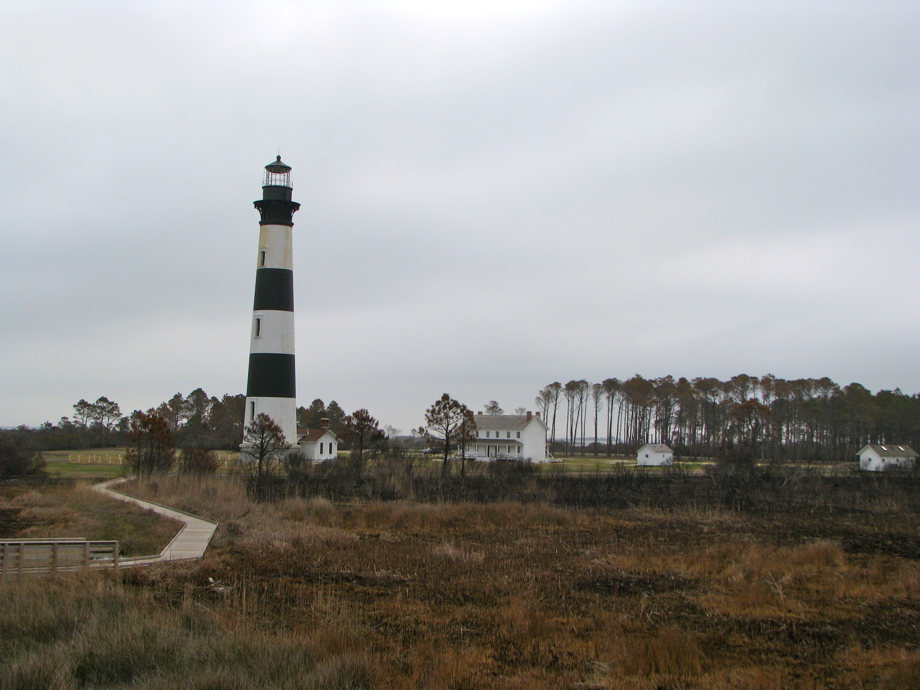
The grounds include a boardwalk leading from the lighthouse to an observation platform a quarter-mile or so into the tidal marshes. This easy stroll allows visitors to appreciate the Light Station from a completely different perspective. The photograph, above, shows the view from that platform. Notice the walkway to the left, and then of course the lighthouse itself as well as various outbuildings that complete the light station.
The Lighthouse
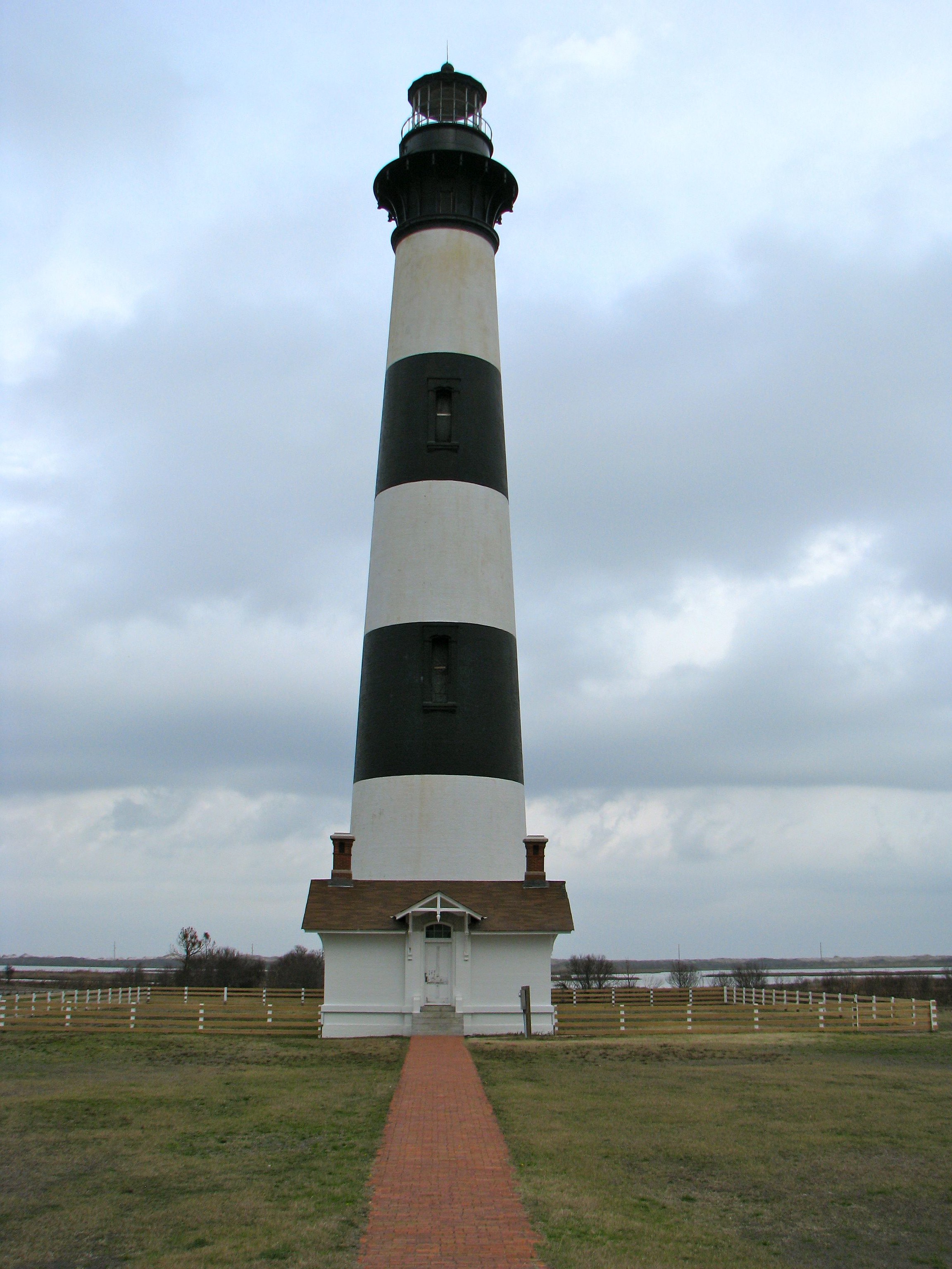
This impressive conical masonry structure climbs 170 feet. The exterior displays distinctive black-and-white bands, with a black tower. The light atop continues to serve as an active navigational aid. Interestingly, the tower contains its original first-order Fresnel lens (a particularly large one). These have been relegated to museums in many instances elsewhere, replaced with modern optics for most light stations that continue to serve as active navigational aids. It’s quite unusual to have an original lens in place that continues to serve its original function.
This incarnation of the lighthouse, the third at this spot, dates to 1872. A previous one was destroyed by Confederate troops during the Civil War to make it more difficult and dangerous for the Union Navy plying waters just off the coast. The current lighthouse fared considerably better, finally electrified in 1932. It became fully automated in 1940. Ultimately the lighthouse transferred from the Coast Guard to the National Park Service in 2003.
It has been undergoing a restoration in recent years although work had been suspended during the time of our visit due to lack of funds. We couldn’t climb the tower during our visit for that very reason. Its condition simply wouldn’t allow it to be opened to the public. However, one can certainly wander the grounds and appreciate its beauty from the outside
The Keepers Quarters
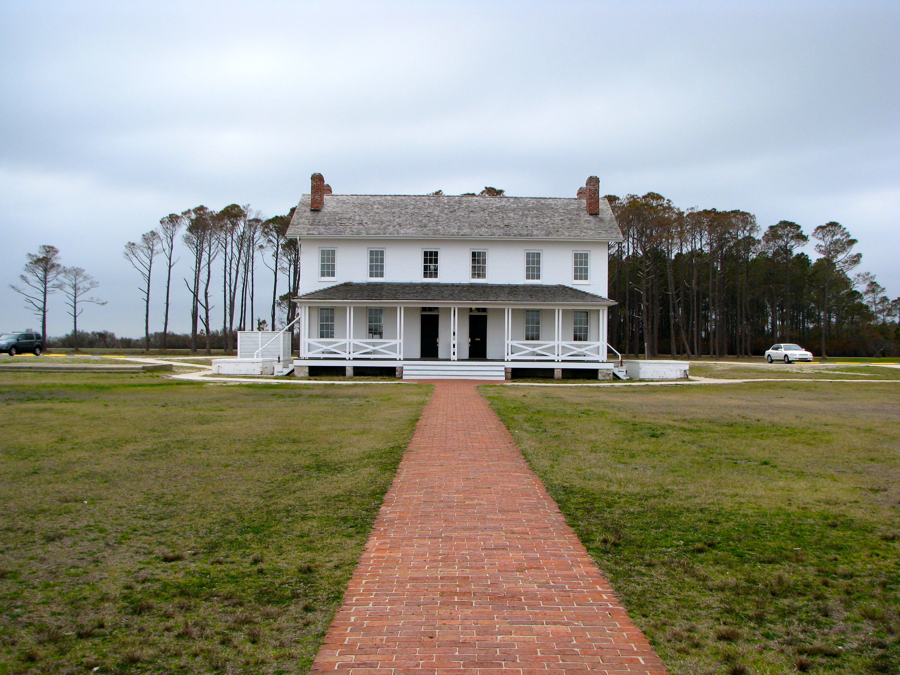
The Keepers Quarters dates from the same time period. It’s been restored and is in considerably better shape. The brick building was designed as a duplex originally. Now the visitors center occupies the first floor and park offices fill the second. The visitors center includes a small exhibit area along with a bookstore. There visitors can find the typical fare one would expect from a Park Service facility. Other structures on the grounds include a cistern, an oil house and a storage building.
Readers who have an interest in lighthouses might also want to check my Lighthouse Index page.
Leave a Reply