
Hatteras Island to Ocracoke Island, North Carolina (March 2012)
We drove down 75 miles of North Carolina’s Route 12, the Beach Road, along the spine of the Outer Banks. This was a long slog even during the winter when the length of highway was blessedly free of tourist traffic. Patience is a virtue.
It took awhile to free ourselves of the strip-mall-choked Kill Devil Hills and Nags Head areas, through the beautiful Cape Hatteras National Seashore where the road was still being repaired from the last Hurricane Season, past tiny towns like Avon, Buxton and Hatteras where speed limits dropped practically to nothing, hopping from island to island until the road ran no further.
From there it’s possible to travel further down the Outer Banks only by boat. That was our goal. Take the ferry to Ocracoke Island.
Catching the Ferry
We arrived at the ferry terminal on the outskirts of Hatteras (map). It’s well marked, and besides, there’s nowhere else to go anyway since its a narrow island and all paths point in a common direction. Two things seemed remarkable upon arrival: (1) the terminal staging area was much larger than we anticipated with several long rows leading to multiple ferry ramps, and (2) we were second in line even though we arrived barely fifteen minutes prior to departure.
That right there demonstrates the difference between summer and winter. During peak times of summer it’s likely that all of those rows fill completely with vehicles waiting to cross over to Ocracoke even with multiple ferries operating simultaneously. In the winter, every vehicle boarded the first available ferry that came along even during the middle of the day, and even though a ferry departed only once per hour.
The price is right, too. It’s free! North Carolina believes that the residents of Ocracoke shouldn’t suffer from isolation, that they should be able to have at least one route to and from the island without having to pay a premium, as well as deliver tourists and the dollars they place into the island economy. It’s a taxpayer subsidy that pays dividends a couple of different ways. We were glad to take the free ferry and leave a few bucks behind for the shopkeepers of Ocracoke Island.
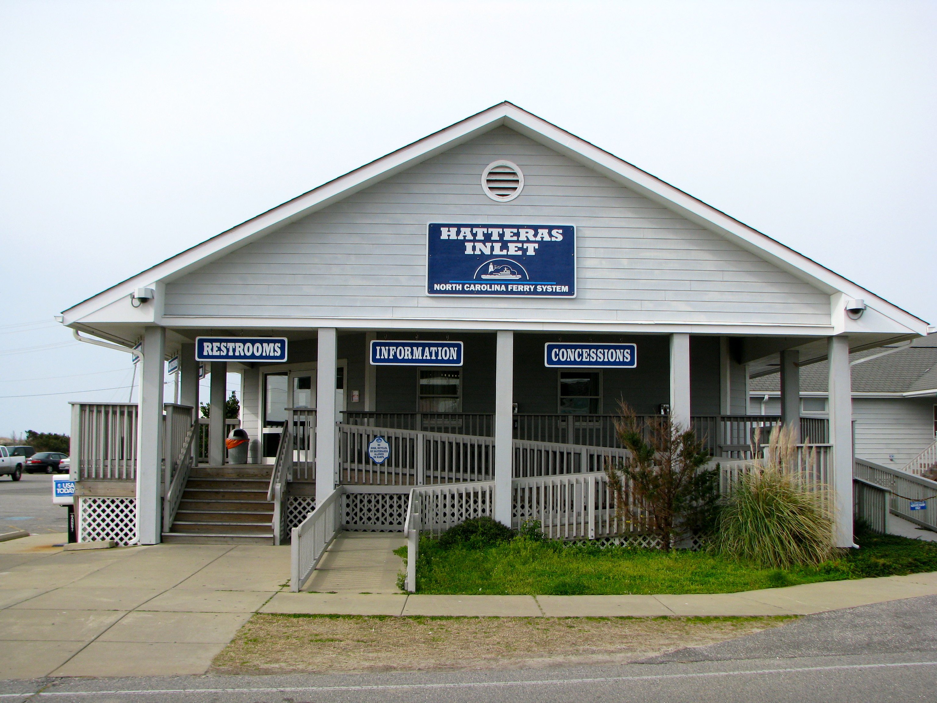
The facilities on the Hatteras side of the route were also pretty nice. As noted on the signs, there were restrooms, information and concessions. The building was staffed and it provided a nice respite as we waited for the ferry to arrive.
The Boats
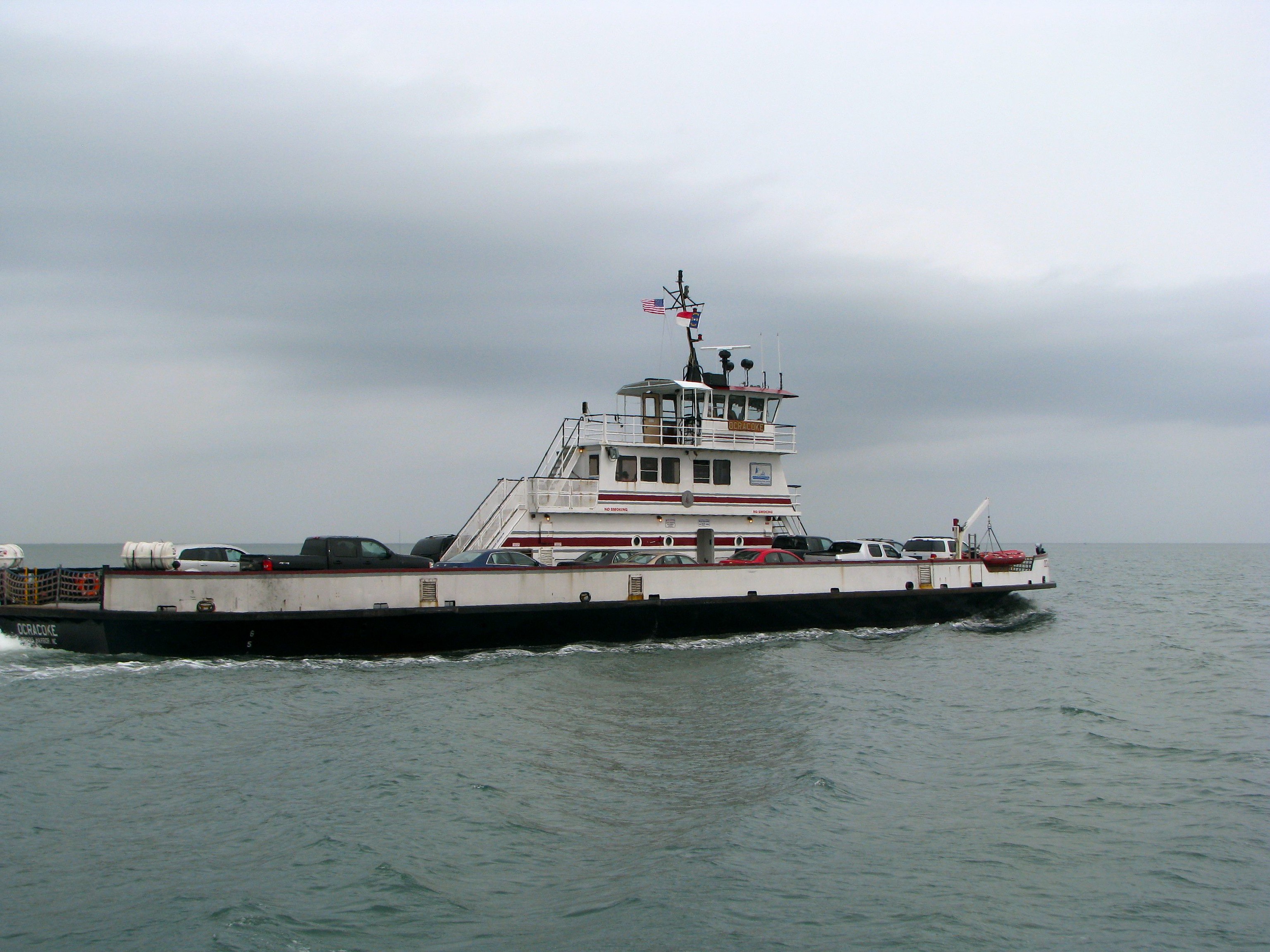
The North Carolina Department of Transportation’s Ferry Division operates several “Hatteras Class” ferries along this particular route. They have a maximum capacity of 26 vehicles and 149 passengers. By weight and dimension, they are 275 Gross Tons, 150′ long, 42′ wide, with a 4′ Draft.
NCDOT also personalizes each of their vessels by painting the trim in colors representing one of their state universities. The ship in this photograph, the ferry we passed going in the opposite direction back to Hatteras, is the Ocracoke which was accented in Maroon and Gray. Those are the colors of North Carolina Central University (NCCU), a historically black university located in Durham. We rode on the Frisco (not named for San Francisco, but for the small town of Frisco on the Outer Banks) highlighted in black and gold, the colors of Appalachian State University (ASU) in Boone. By coincidence we rode on the Frisco twice, from Hatteras Island to Ocracoke Island and on the return trip as well.
On Ocracoke
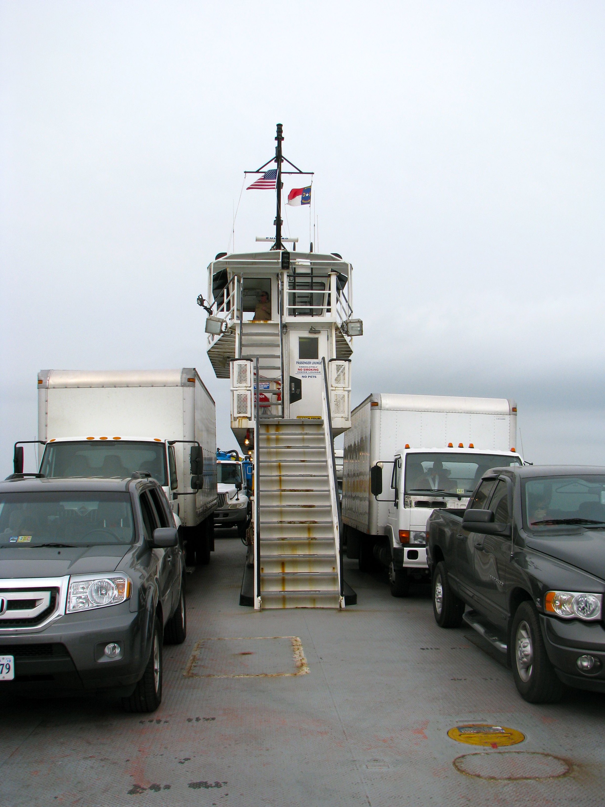
The trip is rather pleasant and it lasts about forty minutes. The journey isn’t done upon arrival at the Ocracoke Island ferry terminal, however. The National Park Service owns practically all of the land on the island except for the tiny village of Ocracoke itself. The terminal is located on the tip of the island closest to Hatteras for obvious reasons while the town is located on the opposite end, about ten miles away.
It’s a pleasant, beautiful drive on a single-lane road through pristine barrier island habitat. However, one would likely want to do this by automobile. It’s probably not very practical for walk-on passengers unless they bring a bicycle along. Thus, it’s not like a lot of ferries that disgorge passengers right at tourist row.
Incidentally, you might wonder how island residents and business owners can get back-and-forth to Hatteras during the summer months when the line backs up. In those instances, the ferry issues a “priority pass” that bump them to the front of the line. We rode back to Hatteras on the ferry with a garbage truck that had just finished its rounds for the day (lucky us). That truck used a priority pass, not that it needed one on a weekday during the winter. It was simply a sign that residents on Ocracoke need the ordinary goods and services of people everywhere, including garbage pickup, but they need the ferry to make it happen. That takes precedence over the tourists.
Readers who have an interest in ferries might also want to check my Ferry Index page.
Leave a Reply