
I thought about rivers, specifically those with segments that disappeared for awhile. It wasn’t about completely subterranean rivers although those were certainly fascinating in their own right. Rather, it was about surface rivers with underground components. I knew they existed because I had a hazy recollection of reading about one once. How rare were they, I wondered, and where did they occur?
Some quick research uncovered several and there were likely many more. I concluded that they might be unusual enough to raise an eyebrow although not something of exceeding scarcity either.
Karst
They also seemed to share a common attribute, found in geographic areas featuring karst topography. Let’s turn it over to the International Association of Hydrogeologists for a simple explanation:
“Karst is a type of landscape, and also an aquifer type. Karst areas consist of solid but chemically soluble rock such as limestone (most important) and dolomite, but also gypsum, anhydrite and several other soluble rocks… landscapes show characteristic landforms caused by chemical dissolution, such as karren (crevices and channels, tens of cm wide), dolines and sinkholes (closed depressions, tens of m in diameter) and poljes (large depressions with flat floor, several km 2 or more). Streams and rivers sinking underground via swallow holes are also frequent. Karst aquifers are characterised by a network of conduits and caves formed by chemical dissolution, allowing for rapid and often turbulent water flow.”

Karst was a German word originally, and referred to the Karst Plateau along the border of modern Italy and Slovenia. This limestone-rich area featured numerous caves. That continued to the present, for example at Postojnska Jama (Postojna Cave) in Slovenia that became a major tourist attraction based on its favorable geological placement (map) within the plateau.
Karst topography is rich with caves. Obviously this offers numerous opportunities for water to disappear from the surface and reappear elsewhere at a lower elevation. Karst areas are widespread and so are the prospects for partially subterranean rivers. I found a few illustrative examples.
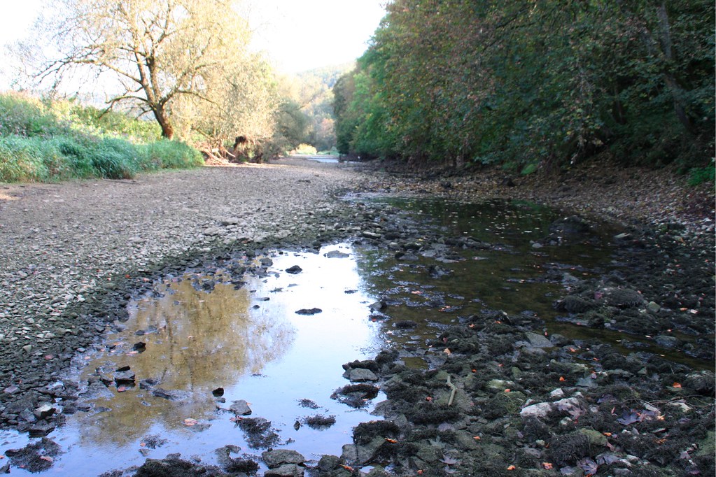
Santa Fe River, Florida

Florida’s Santa Fe River wasn’t huge, stretching only about 75 miles (121 kilometres). However, what it lacked in length it made up for in wonder at what happened at O’Leno State Park:
“Located along the banks of the scenic Santa Fe River, a tributary of the Suwannee River, the park features sinkholes, hardwood hammocks, river swamps, and sandhills. As the river courses through the park, it disappears underground and reemerges over three miles away in the River Rise State Preserve.”
I thought it was great that the reemergence had such a completely descriptive name, “River Rise.” There, the Santa Fe River reappeared “as a circular pool before resuming its journey to the Suwannee River.” The gap was also clearly visible on Google Map’s Satellite View (map).
Lost River, Indiana
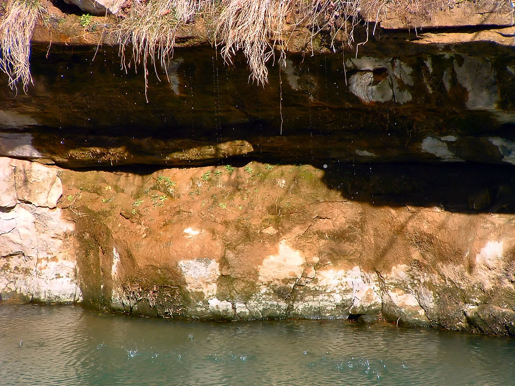
Indiana’s Lost River was another short river. It flowed about 87 miles (140 km), disappearing for as much as 25 miles (40 km) of that distance. The hydrology was different than the Santa Fe River, though. There wasn’t a single sinkhole or rise. Rather, the Lost River began normally enough until flowing onto a karst plateau. Then it disappeared into numerous distinct sinkholes and circulated through untold individual and interlocking channels. Finally it reemerging in at least a couple of different places.
Furthermore, the sinkholes couldn’t drain the entire flow during wetter times of the year. So the river would return to the surface in places. It followed a Swiss Cheese drainage pattern. This feature of the Hoosier National Forest was rather unusual,
“The system can be thought of as a three-dimensional river delta. Depending upon how much water is moving through the system, you could have water in all of the levels. There is no other site in Indiana that matches the Lost River system in terms of the dynamic subterranean hydrology (water movement)… The Lost River is one of the largest sinking streams in the country. The watershed is over 200 square miles.”
The Lost River reemerged permanently and primarily at a place known as the True Rise. Previously it was thought to be the Rise at Orangeville (map), pictured above, which was also supposed to be more picturesque. Orangeville was “the clearest illustration of subterranean stream resurgence in the famed Lost River karst area.”
I also discovered additional occurrences such as the Mojave River in California and the Little Ocqueoc River in Michigan.
A Most Unexpected Example
Remarkably, I discovered that the mighty Danube River, the second longest in Europe flowing 1,785 miles (2,872 km) includes an underground segment, albeit early in its watercourse while still rather diminutive.
The Danube Sinkhole, or Donauversickerung, once again on a karst plateau allowed the Danube to disappear for several miles within Germany before resurfacing at the Aachtopf Spring (map). It was an intermittent phenomenon. Much of the time the Danube had sufficient volume to overcome the drainage. It continued flowing across the surface in a defined channel during those times.
Leave a Reply