
Outside of Kemmerer, Wyoming, USA (July 2011)
Fossil Butte National Monument may be one of the more obscure National Park Service properties but it’s worth a visit if you happen to be traveling through southwestern Wyoming. It’s particularly convenient to people driving out of Salt Lake City, Utah towards the east along Interstate 80. At Exit 18, head north on U.S. Route 189 about 35 miles to Kemmerer. Little traffic exists out here and the distances passes quickly. At Kemmerer, head west on U.S. Route 30 for another 10 miles or so and you’ll arrive at Fossil Butte (map).
The name of the monument pretty much says it all. It’s a butte with fossils. A lake once sat here fifty million years ago, one of several large lakes in the vicinity of today’s Great Basin. This created perfect conditions for the formation of fossils. The amazing layer which exists in various places in the high desert is known as the Green River Formation.
The lake remained for two million years during the Eocene Epoch of the Cenozoic Era. It collected and preserved the remains of fish, plants, reptiles, birds, insects, mammals and anything else that lived and died there. Since then, land all around the butte has eroded away over countless eons. It’s difficult to imagine that the bottom of the lake rested only a hundred feet below the top of an expansive butte today.
However, don’t expect to see dinosaur fossils. The dinosaurs all disappeared about sixty million years ago. They went away long before this lake provided a luscious subtropical habitat more reminiscent of Florida than Wyoming. Nonetheless the fossils found here appear remarkable in so many ways. Many of the best examples can be seen in the park’s compact visitors center.
Chicken Creek Trail
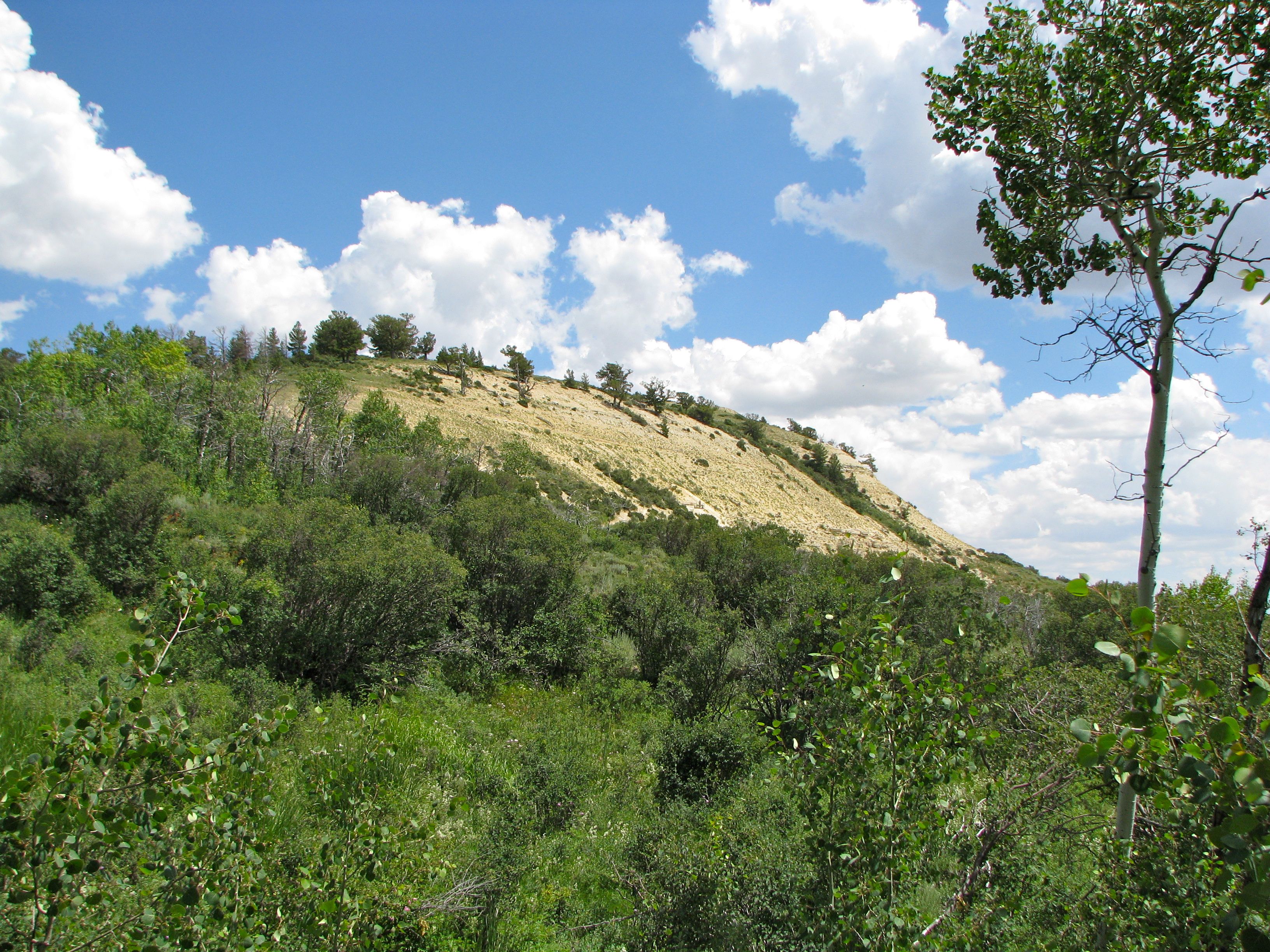
We drove uphill towards the eponymous butte and the Chicken Creek Trail. Upper and lower trailheads both offered small parking areas. However parking never became an issue for us. Most of the people touring through the area didn’t seem to venture away from the visitors center. We stopped at Fossil Butte on a Friday afternoon in the middle of the summer and we barely saw another soul once we started to poke through the various corners of the property.
We parked at the nearest Trail lot, the lower one, because we’d brought our lunch and decided to have a picnic. A shady aspen grove offered a number of tables spread throughout its acreage, including one within a gazebo (which we selected). A drizzle of water runs through the grove — the spring-fed birthplace of Chicken Creek — which is a nice attraction albeit with one small drawback: mosquitoes. The mosquitoes swarmed aggressively and relentlessly. Thankfully we brought repellent.
We hit the trail after lunch, hiking towards the butte with its famously exposed rock and fossil beds. Sagebrush dominated the terrain, interspersed occasionally by small aspen groves where the natural spring gave enough sustenance in an otherwise harsh desert climate. A gentle breeze made the temperature a bit more bearable as it rustled through the aspen leaves. It’s not a particularly challenging trail. Our two young boys had an easy time with the 1.5 mile loop and the 300 foot elevation gain.
Reaching the Quarry

As the Chicken Creek Trail hits its apex and readies for its descent down the other side of the loop, we encountered a small iron gate. Usually it’s closed but it’s open on certain Fridays and Saturdays during the summer. Visitors can pass through the gate and continue upward on those special occasions. It signifies that park staff will be found actively digging in the fossil research quarry.
The two researchers working the dig spotted us long before we finished our climb, and they waved in encouragement as our progress brought us closer to the quarry. We had the undivided attention of the researchers for at least a half-hour as they skillfully and patiently answered dozens of off-the-wall questions from our elementary-aged children.
This photograph shows the appearance of an active excavation. Individual numbered pencil marks identify the location of a fossil that has been discovered and recorded. This is done for each successive wafer-thin layer. Repeat this for what must be hundreds of layers and you’ll begin to gain an appreciation of the richness of the fossil beds of the Green River Formation. The pattern repeats itself uncountable times beyond this one tiny corner of the butte.
Fossils

The most common fossil found at Fossil Butte is an extinct species of herring-like schooling fish called Knightia. They and their coprolites (fossilized dung) appear in great abundance throughout the formation. The park staff showed us this fossil that they had uncovered previously at the quarry, with the outline and bones of the fish clearly visible.
They also let visitors take a stab at fossil hunting. Our kids pulled up thin layers and uncovered two smaller Knightia fossils superimposed upon each other. The researchers numbered the specimens and recorded their find in a ledger. Eventually these fossils will be entered into a database and become available on the Internet. They gave our kids a little card with the numbers so they can look them up someday.
Alas, that’s the only souvenir visitors can legally take away from the quarry. All fossils in the National Monument belong to the people of the United States and cannot be removed by private citizens for personal purposes. Researchers carefully mark and catalogue all items as a contribution to the scientific record.
Fossil beds falling outside of the park boundaries on private land allow hunting at a price. Also several galleries in Kemmerer sell specimens for those who simply must own a professionally mounted fossil for their living room wall.
Bonus!
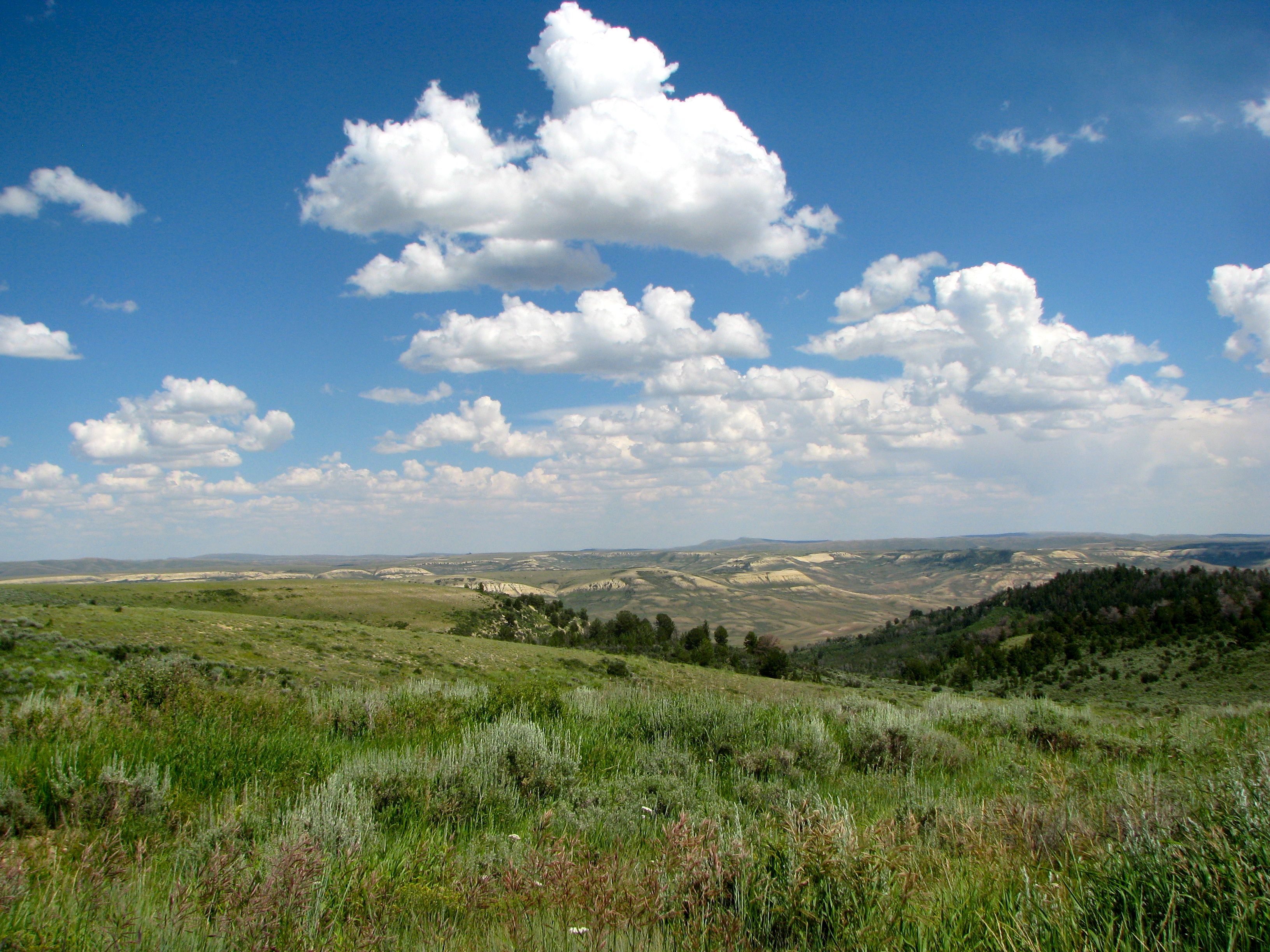
One more area of the park receives even fewer visitors. The road turns from asphalt to gravel beyond the upper parking area for the Chicken Creek Trailhead. It climbs steeply up the side of the butte through a couple of sharp hairpin switchbacks until it reaches a crest, then continues onward along a much flatter plateau.
Trails radiate from the path to even more remote areas. We encountered a sign reading “no sedans or RV’s beyond this point” after about four miles of rugged gravel. This marked the park’s northernmost extreme, the end of the line. The trail continued onward but not for anyone without 4-wheel drive, and frankly the view wouldn’t have been any better than what we’d already seen here above 8,000 feet.
By the way, in spite of what the sign said, I would not advise anyone bringing an RV up to the top of the butte. A sedan driven carefully in a lower gear handled the road just fine. The park obviously maintains the road and I saw no sign of washboards. However, an RV would have serious issues with the grade and the switchbacks even in perfect conditions.
Leave a Reply