
There are 10 Counties in New Hampshire – “The Granite State“
Also be sure to see my United States County Counting Page for the rest of the states.
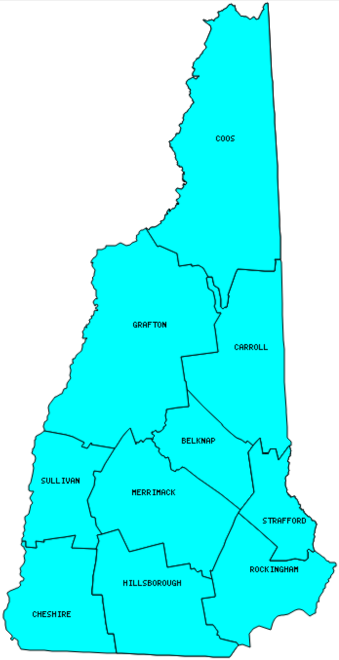
I have visited 10 Counties = 100% of Counties in New Hampshire
Counties visited are colored-in; counties still needing to be visited are blank. Map created using Mob Rule.
Twelve Mile Circle Articles Featuring Places in New Hampshire
Markers designate the New Hampshire locations featured in Twelve Mile Circle articles.
Counties in New Hampshire

Below are the 10 counties in New Hampshire. Although infrequent, counties sometimes do change so please let me know if any of this information is out of date and I will update it. Those counties that I have visited are highlighted in Red. Readers can also link to any articles manually in this section if the map isn’t working.
- Belknap
- Carroll: First Votes in New Hampshire Presidential Primary and Election; Sawtooth and Knob Borders of Carroll County, NH; Cog Railways
- Cheshire: Warning at the Border; Going Postal
- Coos: Largest county in New Hampshire (1,801 square miles) and smallest county population in New Hampshire (33,111 people in 2000 Census); Closest Border Monuments – Found!; Republic of Indian Stream
- Grafton
- Hillsborough: Largest county population in New Hampshire (380,841 people in 2000 Census); Hancock; County Bridge; Right Up to the Line; Short Distance Namesakes; Drive Me Crazy; Martha’s Exchange Restaurant & Brewing Co.
- Merrimack: Henniker Bridge; Rowell’s Bridge; Contoocook Railroad Bridge; Improbable Connections; Insignificant Synonyms; Flying Goose Brew Pub & Grille
- Rockingham: Isles of Shoals
- Strafford: Smallest county in New Hampshire (369 square miles); A Little History Too; Insignificant Synonyms.
- Sullivan: NOT the Longest Covered Bridge; Cornish-Windsor Bridge; Saint-Gaudens National Historical Park.
Quick Facts About New Hampshire
- Location: New England region of the United States. See map above.
- Size(1): 8,953 square miles. New Hampshire is the 44th largest state. The next larger state is Vermont and the next smaller state is Massachusetts.
- Population(2): 1,356,458 people. New Hampshire is the 41st most populous state. The next more populous state is Hawaii and the next less populous state is Maine.
- Population Density: 151.5 people per square mile. New Hampshire is the 21st most densely populated state. The next more densely populated state is Tennessee and the next less densely populated state is Washington.
- Bordering States: New Hampshire shares a border with 3 states: Maine, Vermont and Massachusetts.
- Admission to the Union: June 21, 1788. New Hampshire was the 9th state admitted to the Union, after South Carolina and before Virginia.
- Capital: Concord.
- Highest Point: 6,288 feet at Mount Washington. See SummitPost’s Mount Washington page.
- Lowest Point: Sea Level at the Atlantic Ocean.
- Government website: NH.gov – The Official Web Site of New Hampshire State Government.
- Official Tourism website: Welcome to New Hampshire.
- Still not enough? See Wikipedia’s New Hampshire page.
Sources:
(1) Wikipedia: List of U.S. states and territories by area. Land area only.
(2) Wikipedia: List of states and territories of the United States by population. Estimated population on July 1, 2019.
Leave a Reply