
Located in Arlington and Alexandria, Virginia (Visited 2000-2010)
Beginning in 1791, a survey party placed stones marking the boundary of the District of Columbia, one mile apart in a diamond pattern, ten miles on a side. Two thirds of the land came from Maryland and one third from Virginia. This land formed the new capital of the United States of America.
The Federal government returned Virginia’s portion in an 1847 “retrocession” (approved by Congress 1846, accepted by Virginia 1847). This former piece of the District of Columbia today forms the County of Arlington and a section of the City of Alexandria, Virginia. For more information on the retrocession see The Arlington Historical Magazine, Volume 6 Number 2 (1978), “When Arlington was part of the District of Columbia,” by Dean C. Allard.
Many of those old stones remain in place, including some marking the pre-1847 boundary. The photographs on this page show several of the stones that mark a District of Columbia boundary that no longer exists. I hope to be able to return someday and capture more.
If you want to see photographs and a map of many of the stones, please visit Mark Zimmermann’s wonderfully researched and beautifully compiled District of Columbia Boundary Stones: Photos & GPS Waypoints page.
Historic Markers
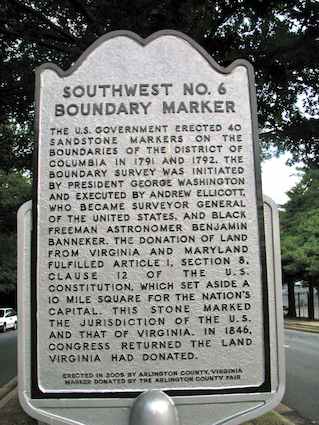
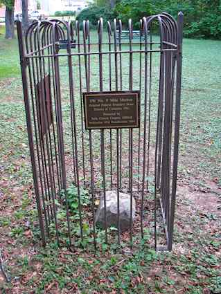
Local governments have posted historic markers near some of the old boundary stones. Arlington County posted this one near Southwest Stone 6. A nearly identical marker can be found at Southwest Stone 8. It reads:
“The U.S. Government erected 40 sandstone markers on the boundaries of the District of Columbia in 1791 and 1792. The boundary survey was initiated by President George Washington and executed by Andrew Ellicott, who became Surveyor General of the United States, and black freeman astronomer Benjamin Banneker. The donation of land from Virginia and Maryland fulfilled Article 1, Section 8, Clause 12 of the U.S. Constitution, which set aside a 10 mile square for the Nation’s capital. This stone marked the jurisdiction of the U.S. and that of Virginia. In 1846, Congress returned the land Virginia had donated. Erected in 2005 by Arlington County, Virginia. Marker donated by the Arlington County Fair.”
The South Cornerstone
The first boundary marker placed was at the southern corner. From here the survey party continued northwest and then up and around the perimeter. The photograph above shows the first stone. It is located at the Jones Point Lighthouse in Alexandria, near where the Woodrow Wilson Bridge crosses the Potomac River. To get this view, one must walk onto the rocks along the riverbank directly in front of the lighthouse. For an easier view, there is a peephole directly above the stone (look towards the top of the photo) next to the little plaque at the edge of the lighthouse lawn.
Southwest Stone 4
Southwest Stone 4 sits along the northeast side King Street just up from Wakefield Street. Parking is difficult because of the number of apartments with reserved lots and few visitor spaces. I viewed the stone early on a Saturday morning just after dawn. I parked in a reserved space off of Wakefield St., betting that nobody would be awake to either miss the spot or tow me out of it. It was a quick walk up to and around the corner onto King St.
Southwest Stone 5
I faced similar parking issues for Southwest Stone 5. This one sits on the north side of S. Walter Reed Drive, just east of its intersection with King Street. A bank sits at the intersection, and as tempting as I found its parking lot I happened to spot a free space along S. 25th Street. It was a short walk down an embankment from there, directly onto S. Walter Reed and over to the marker. I’d be careful about the bank lot. It’s reserved for customers with 24 hour towing as pointed out by several signs. Tow truck operators are very aggressive in Arlington and it only takes a second to lose your car any time of day.
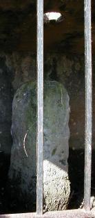
Southwest Stone 6
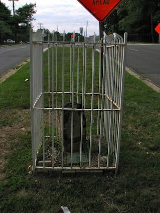
This one is an easy catch. Unlike other stones resting in the underbrush along busy roadsides, Southwest Stone 6 sits directly on the median of Jefferson Street, between Leesburg Turnpike and Columbia Pike. It’s easily visible and readily accessible. Hundreds of people pass directly by here every day and probably don’t realize its significance, or perhaps think it’s a tombstone or something. Public parking lines both sides of Jefferson St., although there are large apartment buildings nearby so you might have to hunt for a spot.
Southwest Stone 7
Visiting Southwest Stone 7 is a breeze. It’s situated towards the far end of the S. 5th Road parking lot of Carlin Spring Elementary School. You can park literally twenty feet away from the boundary stone, directly in front of it. I would highly recommend visiting at some time other than school hours. They might not appreciate a stranger wandering around school grounds with a camera while classes are in session and kids are romping about the playground. My early weekend morning visit went off without a hitch.
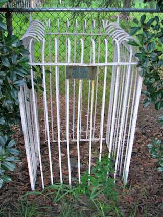
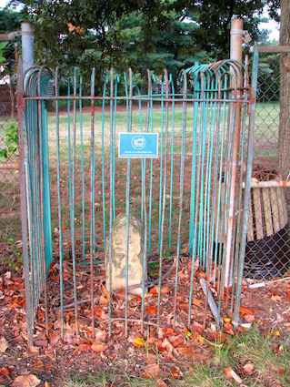
Southwest Stone 8
Things begin to get a little more difficult again with Southwest Stone 8. It’s easy enough to locate. Just look for the large water tower on the hill on the south side of Wilson Boulevard, heading away from Seven Corners. It’s not easy to get to it, though. You’ll have to use John Marshall Dr. and circle around behind it. That puts you in the middle of an apartment complex with very little available parking. I did another click-and-dash stop here, commandeering a reserved parking spot for about two minutes. The boundary stone isn’t directly beneath the water tower but it’s very close so keep the water tower in sight and this one won’t be difficult to find.
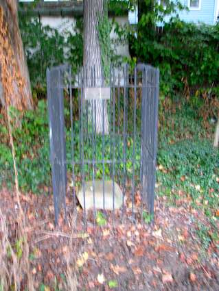
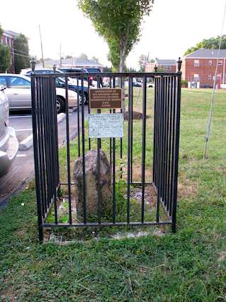
Southwest Stone 9
Fortunately the hunt gets easy again with Southwest Stone 9. It sits in a pretty little park in a quiet neighborhood on Van Buren St., very near the East Falls Church subway station. It’s very relaxed with plenty of street parking. I found it amazing that it was only a mile away from the dense urban neighborhood of SW8.
The West Cornerstone
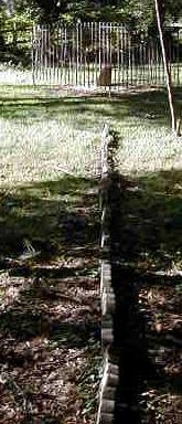
The cornerstone at the former western boundary rests in a small park maintained by the City of Falls Church and the Counties of Arlington and Fairfax, Virginia, where all three jurisdictions come together at a point. Someone placed bricks to mark the approximate boundary line. In the photograph above, Falls Church is on the left and Arlington is on the right. The boundary stone sits in the distance inside the small fence. The park can be reached quite easily from Arizona St. in Arlington.
Leave a Reply