
Larimer and Grand Counties, Colorado, USA (October 2002)
We came to Denver for a wedding but we arrived early so we could travel up to Estes Park, Colorado (map). That serves as the gateway to Rocky Mountain National Park. Summer quickly transitions into winter here. Trail Ridge Road through the upper elevations of park closed for the season a week later.
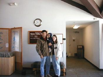
The Alpine Visitor Center stands at 11,796 feet (3,594 meters). While it’s not the absolutely highest point along the Trail Ridge Road it is nearly so. In any case it’s certainly the most inviting spot. It’s also the best place to warm up before venturing back along the track. Trail Ridge Road is reputed to be the “highest continuous highway” in the United States and is part of US Route 34.
Effects of Elevation
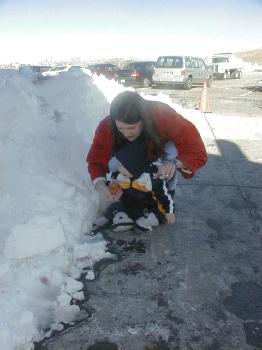
It doesn’t take much to have snow near the top of these peaks. It was a bright, sunny day but snow had visited the park already that season and stood in neatly plowed piles along the edge of the Alpine Visitor Center parking lot. I chatted with one of the rangers and learned that it wasn’t uncommon for people to pass-out in the parking lot due to oxygen deprivation. It’s such a quick drive up from Estes Park that visitors often do not have a chance to acclimate to the changing elevation. A brisk walk across the lot can knock some people out.
The Great Divide
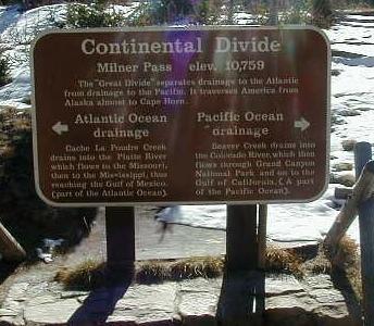
Rocky Mountain National Park straddles the “Continental Divide.” More accurately it resides atop the eastern/western continental divide which is the most well known of four commonly-recognized North American divides. Sometimes it is also called the “Great Divide.” The Continental Divide at this specific location also marks the separation between Colorado’s Larimer County (left) and Grand County (right). The sign is a little difficult to read in this compressed, low-resolution scan, so here is what it says:
Continental Divide
Milner Pass elev. 10,759
The “Great Divide” separates drainage to the Atlantic from drainage to the Pacific. It traverses America from Alaska almost to Cape Horn.
Atlantic Ocean drainage [arrow pointing left]
Cache La Poudre Creek drains into the Platte River which flows to the Missouri, then to the Mississippi, thus reaching the Gulf of Mexico (part of the Atlantic Ocean).
Pacific Ocean drainage [arrow pointing right]
Beaver Creek drains into the Colorado River, which then flows through Grand Canyon National Park and on to the Gulf of California (A part of the Pacific Ocean)
The Scenery
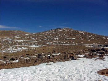
Below are some scenic views of Rocky Mountain National Park that I photographed as we drove along the Trail Ridge Road. I did not record the names of these peaks because I was lightheaded and not thinking as clearly as I would usually. Hopefully you can enjoy these simply for their natural beauty.

Jagged Rocky Mountain peaks puncture the horizon in every direction.
It was around this point in our journey when we realized our personalities had changed due to lack of oxygen. We became lethargic and cranky so I pointed the car towards lower elevations and we soon recovered.
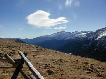
Here we are well above the timberline. Nothing much grew at this altitude and the foreground appeared desolate and bleak. Only a crude wooden fence separated spectators from the chasm below.
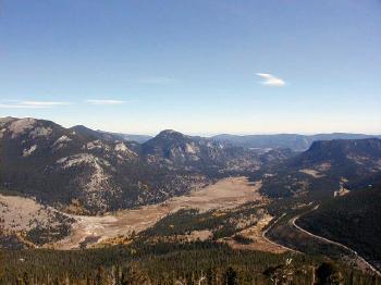
Notice the road snaking off towards the horizon on the lower-right part of the photo. It’s a lower-elevation portion of the Trail Ridge Road that we took to get up to this panoramic overlook by way of multiple switchbacks.
Leave a Reply