
Charleston Harbor, South Carolina (September 2008)
The Civil War started at Fort Sumter (map) and its hallowed grounds take on mythic proportions in our collective memory. Perhaps most striking to us, therefore, was its size. It’s tiny. And the island it sits atop is barely larger. I had envisioned something much bolder, something perhaps matching its storied past not this speck upon the water. In spite of its demure stature though, it was a defensive powerhouse during its day.
Getting There
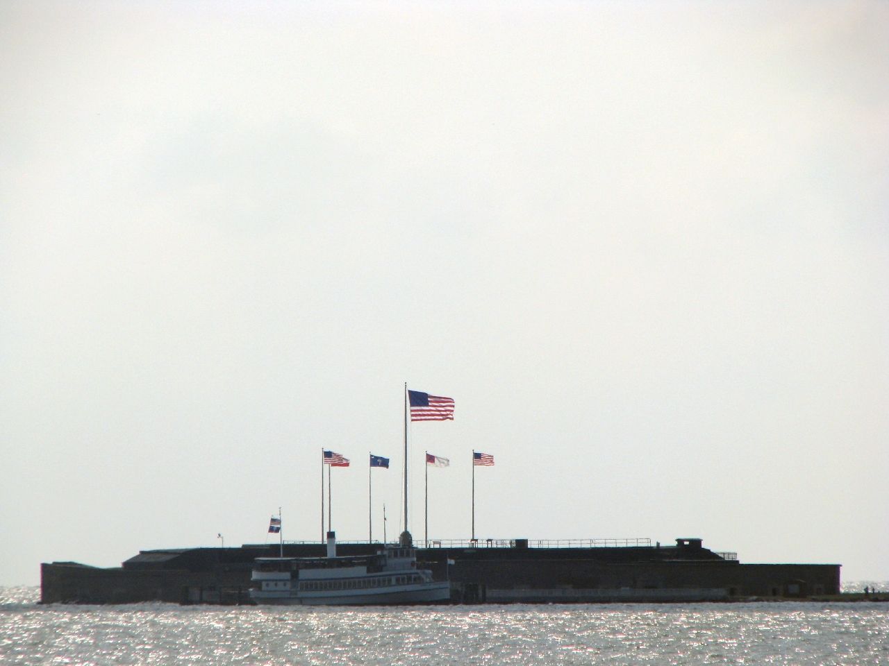
We sailed on one of the regularly-scheduled boats between Patriots Point and the fort, cutting straight through choppy waters and a stiff breeze. Another ferry left from the opposing bank at Liberty Square in downtown Charleston. Our day of touring included the USS Yorktown so leaving from Patriots Point was the more convenient choice.
The ship seen in the photo above, moored at the island dock departed just as we arrived. In that manner the National Park Service could prevent the site from being overwhelmed by visitors. In turn, our ship would be replaced by another just as we left.
Building an Island
The boat ride through Charleston Harbor included some historical narration and went into the background on how the fort came along. It was interesting enough but my mind focused more on the terrain and the growing lump on the horizon. We learned that it straddled a man-made island composed of huge blocks of granite transported from New England. Predictably the narrator made a crack about “Yankee Soil” which registered barely a polite chuckle from the crowd.
Only a sandbar would exist if stone hadn’t been dumped here, and its shifting soil would never support the weight of a fort. Granite formed the firm foundation that allowed a fort to rise at mid-harbor. It could fully defend Charleston when combined with Fort Moultrie (see my Fort Moultrie page) and other batteries nearby.
Original Walls

These walls are the only surviving remnants of Fort Sumter’s original Left Face and Left Flank. This is a view from the modern wharf as we disembarked from the ship and walked towards the island. Small rooms called casements ringed the entire perimeter of both walls here. Casements protected cannons inside their thick masonry walls but included small apertures that allowed them to target incoming ships. These openings have been bricked over in the modern ruin but their shapes are clearly visible along a horizontal line above the slapping waves. The original walls would have stood much higher. A second row of casements rose above what can be seen here today. They were pulverized during the war.
The Parade Ground
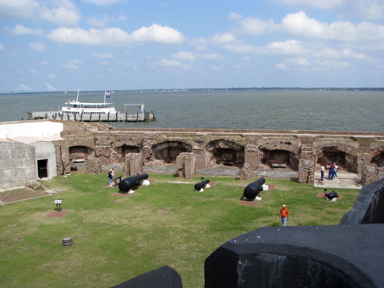
Fort Sumter continued to serve the Nation after the war and in spite of its near-destruction. It was even refitted during the Spanish-American war at the end of the 19th Century. However, it never again fired in anger. A large concrete fortification rose straight across the Parade Ground as part of the upgrade, from one side of the fort to the other. The Army named it Battery Isaac Huger after a South Carolina general from the Revolutionary War.
Casements
This structure dominates the current fortress and provides an excellent vantage for amateur photographers such as myself. This shot peers across the ruins of the original Left Face. Notice the individual casements along the rim of the wall. The cannons placed in front of each casement at the far edge of the Parade Ground are for display purposes. During the conflict they would have been located deep within the casements where they could rotate along iron arcs built into the floor. They could also swivel up and down to adjust trajectory. In this manner they could accommodate a wide range of horizontal and vertical angles.
Vistas
Battery Huger also provides a great view across Charleston Harbor. From this vantage one can see the tour boat docked at the island wharf in the foreground. The Arthur Ravenel bridge, one of the longest cable-stayed bridges in the world, carries traffic across the Cooper River between Charleston and Mount Pleasant. It rises on the left side of the horizon. Immediately to its right is Patriots Point from where we began our voyage.
To the far right is Sullivan’s Island with Fort Moultrie, one of the coastal batteries that turned its guns on Fort Sumter on that first day of the war in April 1861. Union troops abandoned Fort Moultrie about three months before the conflict began and moved to Fort Sumter, which at the time was still under construction. They felt this would be a better defensive position and in a sense they were right. However it also left them isolated with no means to resupply.
During the Civil War
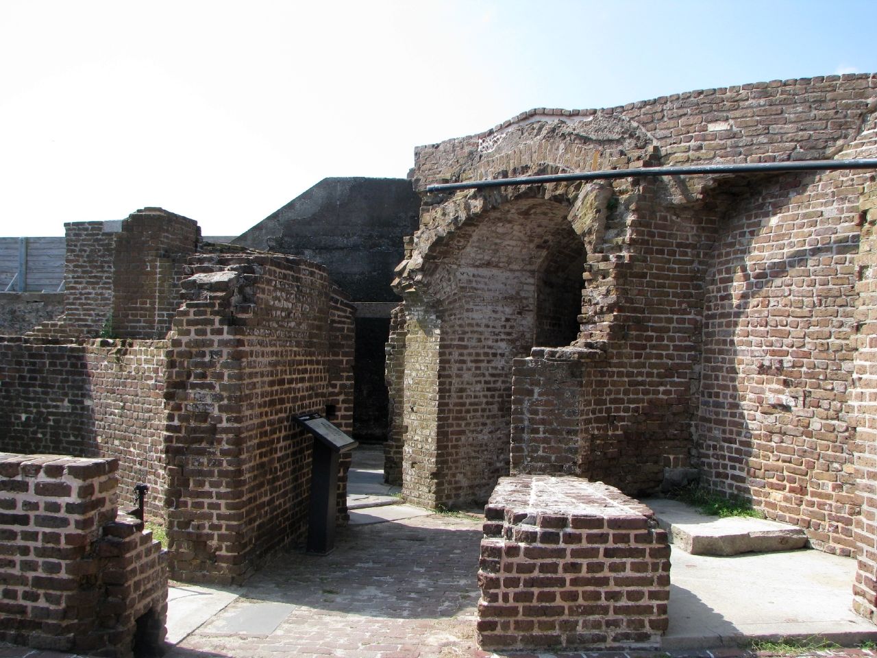
These are the ruins of the officers quarters found at the left gorge angle at the back side of the fort. Originally the gorge stood three stories high and held living space along with administrative offices, storerooms and powder magazines. A wide granite esplanade ran the entire length of the exterior gorge wall. A wharf protruding into the harbor from the base of the original sally port entrance. These features are long gone. This was all that remained of the gorge wall as hostilities concluded..
Fort Sumter saw fierce action during the war, and not just during those first days when Federal troops surrendered their isolated position. As the war continued the Union came to view the fortress as an irritant, a weakness in their otherwise mighty blockade of Confederate ports. Union troops rained several million pounds of shells onto the fort in the final twenty months of the war. Fort Sumter held and Confederate forces refused to surrender their dug-in position. Eventually they evacuated but only as General Sherman advanced north after capturing Savannah near the end of the war. Only then did Fort Sumter return to Union hands.
Flags
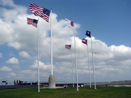
Twenty feet of dirt fills the space between Battery Huger and the Right Face and Flank, in contrast to the Parade Ground and exposed ruins on the northern side of the island. Several flagpoles have been placed here atop a grassy plain. These sentinels are Sumter’s most visible feature from a distance, either from shore or boat. It serves as a visible reminder that the citizens of Charleston could easily have seen the raising of the Confederate flag in 1861 from the shoreline with their own eyes.
Representations
Each flag here has significance. The central flag with the elaborate masonry base is the modern 50 star United States Flag. Forming an arc around it, right to left (farthest away to closest) are modern reproductions that represent moments in time:
- 33 star United States flag, representing the one that flew above Fort Sumter when it fell in 1861
- First national flag of the Confederacy, in use in 1861 when rebel forces captured the fort
- South Carolina state flag, the state where Fort Sumter stood and stands
- Second national flag of the Confederacy, in use during the 1863-1865 defense
- 35 star United States flag, from 1865 when the fort returned to Federal hands.
There is one more interesting feature, a red band around one of the flagpoles. I’ve marked it with a yellow arrow in the photograph above. This was Fort Sumter’s height before the Civil War began. Consider for a moment that the band is 50 feet above sea level. That shows rather dramatically the amount masonry that cannons pounded to rubble during the conflict.
Readers who have an interest in forts might also want to check my Forts, Fortresses and Fortifications page.
Leave a Reply