
Between Dorena, Missouri and Hickman, Kentucky (April 2014)
No direct roadway crosses the Mississippi River between the states of Kentucky and Missouri. In fact the river lacks a single bridge crossing for a distance of nearly 85 miles (140 kilometres) from Cairo, Illinois to the Interstate 155 bridge west of Dyersburg, Tennessee. The Dorena-Hickman Ferry (official website) provides a valuable service to those who live within the under-served stretch.
The ferryboat Dorena II creates a means for residents from the unincorporated community of Dorena, Missouri, to connect directly with those from the town of Hickman, Kentucky on the opposite bank. By extension it allows people in larger towns such as New Madrid, Missouri and Union Center, Tennessee to do the same. It can be a significant time saver delivering up to a dozen automobiles across the Mississippi River at a time during daylight hours, seven days per week; or a larger combination of motorcycles, bicycles or foot passengers.
I suspect a lot of the traffic comes from people who want to experience the nostalgia and romance that comes from crossing the Mighty Mississippi the “old fashioned way” instead of using it as a shortcut. Certainly all three of the vehicles present during our ferry ride on a sunny Saturday afternoon — ours included – were filled with people there to experience a wonderful anachronism along the Great River Road. Perhaps more local traffic uses the ferry for utilitarian purposes during the week.
Catching the Ferry

It’s not difficult to find and hail the ferry, requiring little more than a good map or GPS and some patience.
- On the Missouri side: The dock is located where Missouri Highway “A” hits the river. The latitude/longitude coordinates for a GPS are 36.586691,-89.214726
- On the Kentucky side: The dock is located just off of Kentucky Route 94 on the western side of Hickman. The latitude/longitude coordinates for a GPS are 36.567744,-89.212022
It’s vitally important to check the ferry status before heading towards the docks. While the Dorena II operated daily generally speaking, the equipment, the river or the weather might have other ideas. Sometimes the ship needs maintenance or repairs. Other times the water levels are too high or it’s too windy.
For example, we experienced fine weather during our crossing and then the ferry was closed the very next day because of the wind. Check the status on the ferry’s Facebook page or call the phone number listed on their website. You don’t want to get all the way out to the dock and then discover the ferry isn’t running that day, and suddenly face an hour-long detour.
It may be necessary to hail the ferry from the dock if you don’t see it. Push the button on the pole (it’s clearly marked) or call the telephone number listed on the website (also listed on the pole when we were there). That will let the captain know you’re waiting to come across.
Getting Aboard
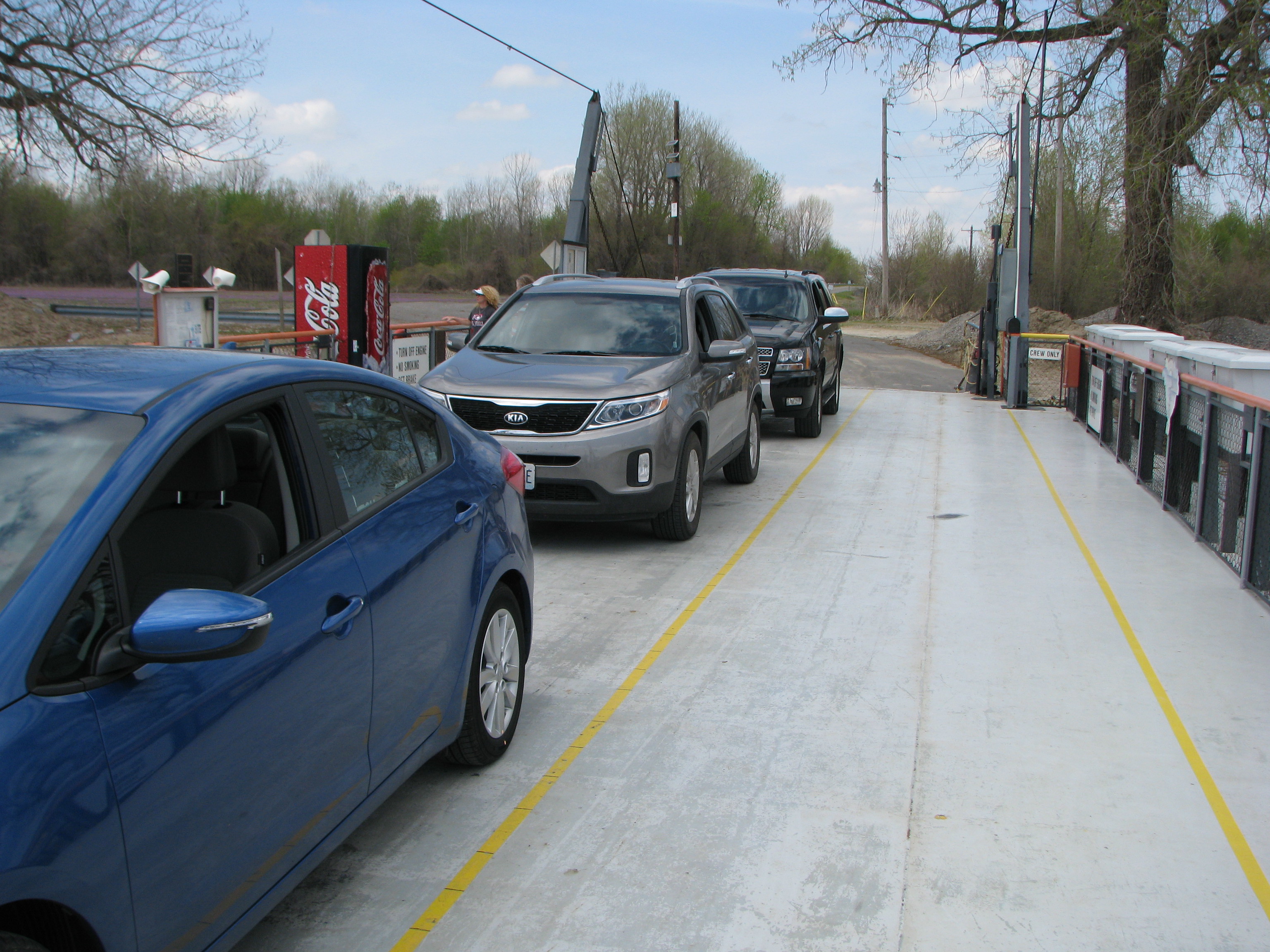
Wait at the dock, be sure let the vehicles exit the ferry once it arrives, then drive onto the ship at the direction of the deckhand. Simple. The deckhand also serves as the ticketmaster, collecting necessary fares for a voyage across the river.
Tolls are collected by vehicle size with prices listed on their website. There were even options for horses, horse drawn wagons, bicycles and pedestrians, plus discounts for return trips and multiple trips. I’m not sure where pedestrian might go, especially on the Dorena side, so that seemed odd. Walk to where? It seemed rather sparse. I did notice a couple of people fishing so maybe that would be a possibility; ride across from Hickman, fish for awhile and then return. Nonetheless if someone wanted to cross the Mississippi River on the cheap I suppose a pedestrian fare might be the way to go.
Riding Across
The crossing itself was rather pleasant and uneventful. Our voyage headed downstream because we began on the Dorena, Missouri side of the river. The current was rather strong due to recent rains and we moved quickly.
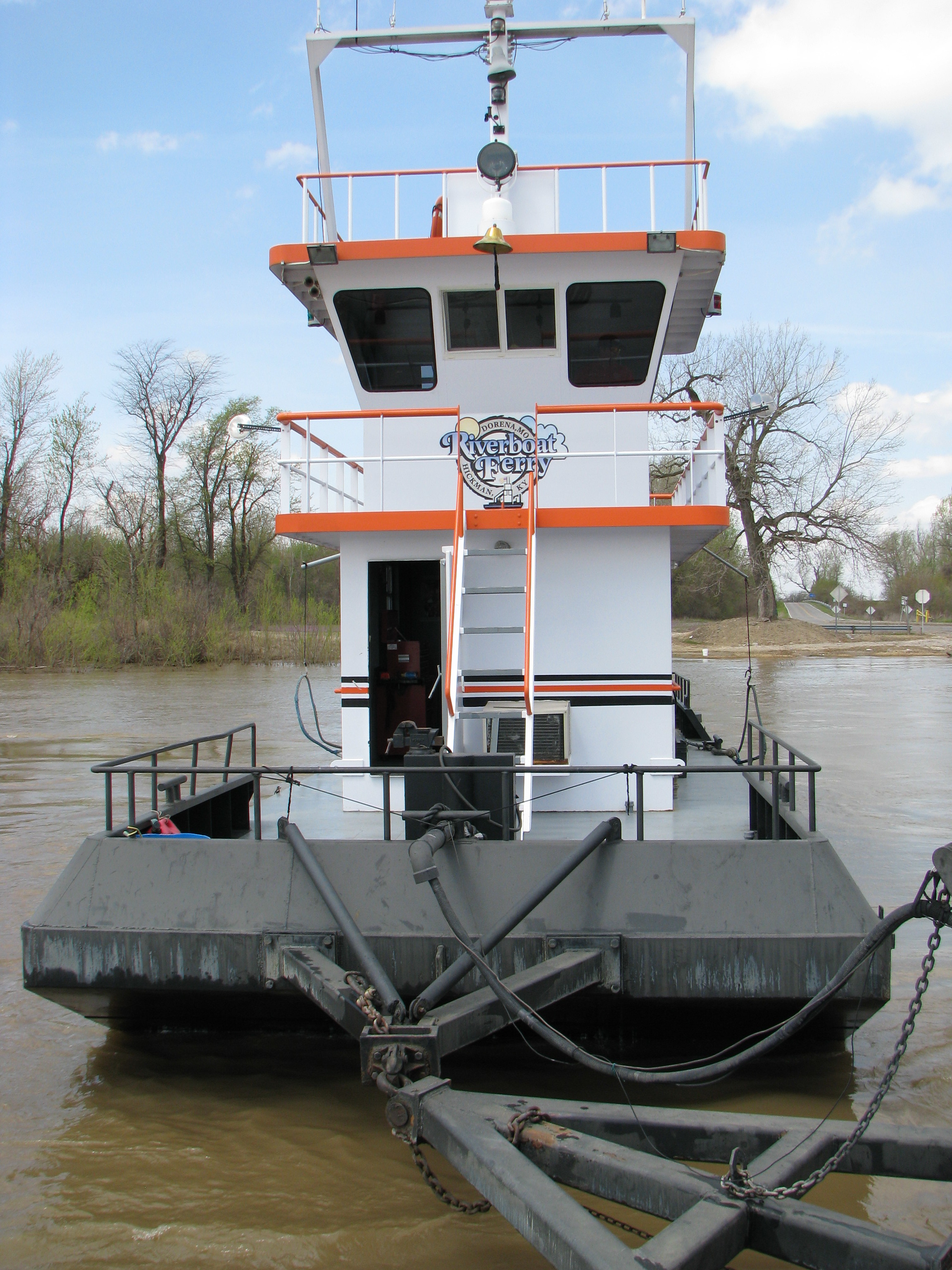
The upstream run, I noticed, went much more slowly. We could watch the ferry as it approached while we waited at the dock, maneuvering to move forward through eddies and other places where the current ran slower. The Dorena II featured a design I’d not seen before. Essentially it was a tugboat connected to a barge by a swivel. That seemed to provide greater flexibility to negotiate through the swirling ebb and flow.
I would describe the barge as functional and spartan. We were able to get out of our car while underway and walk around the deck, although there wasn’t much to it. Still, it was nice to stretch our legs. Additionally a soda machine and porta-potty were attached to the deck in case one needed either of those amenities. I’ll admit the porta-potty came in handy after having driven through rural Missouri countryside and then waiting for the ferry for another twenty minutes or so.
Too soon, the Dorena II delivered us to the Kentucky side of the river and we drove off to our next adventure.
Wolf Island
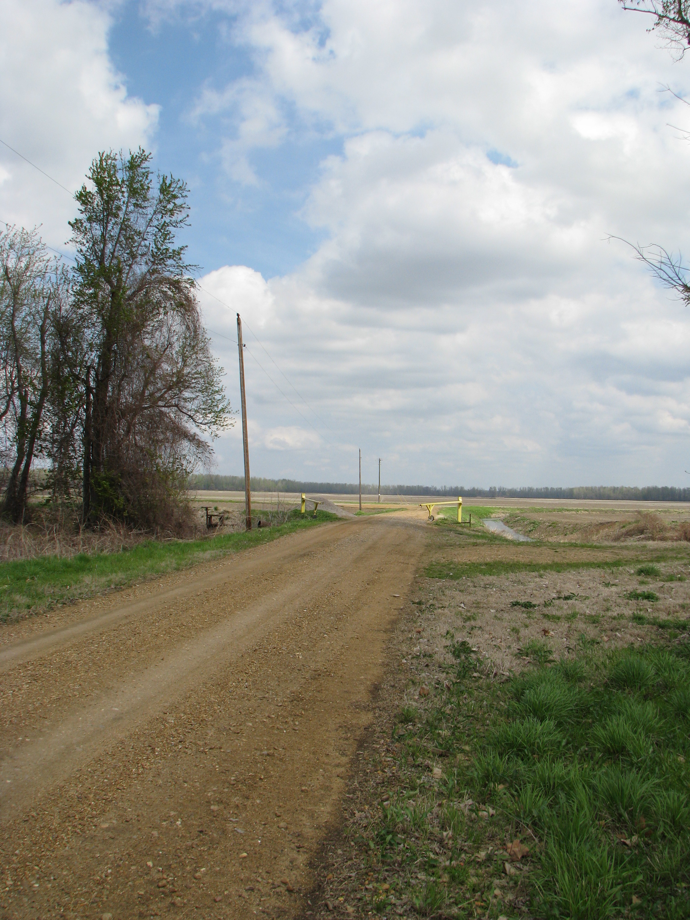
I had one more point sort-of related to the Dorena-Hickman Ferry. Many websites I consulted said that the ferry was the ONLY crossing between Missouri and Kentucky. Actually, that’s not true and I experienced the exception in person a few miles upriver from the dock. There is a small corner of Kentucky on the “wrong” side of the Mississippi River appended to Missouri due to changes in the path of the river over time.
It’s called Wolf Island and it was the subject of a Supreme Court decision in 1870, Missouri v. Kentucky. The Court ruled that Wolf Island had been connected to the rest of Kentucky until the river shifted so it should remain part of Kentucky even though it was now connected physically to Missouri. It’s just a short jog from Missouri’s Route 80 as one heads down towards the river to the Battle of Belmont historical marker, and only the final short segment is a gravel road. The latitude/longitude coordinates for a GPS are 36.755433,-89.143083
Readers who have an interest in ferries might also want to check my Ferry Index page.
Leave a Reply