
I’ve certainly noticed Florida’s northeastern bump above Jacksonville, and then the Georgia dip just to the west, both of which contrast with their generally straight remaining border. Sure, we’ve all seen it before and taken note of it. The meandering border through that segment follows the St. Marys River that rises from the depths of the Okefenokee Swamp and flows to the sea.

However, I didn’t know about all of the other St. Marys Rivers in North America. Most strikingly they had very little in common with each other besides their shared name including a lack of an apostrophe, as consciously removed by the U.S. Board on Geographic Names and the Geographical Names Board of Canada.
These differences may be appreciated best photographically.
Florida / Georgia
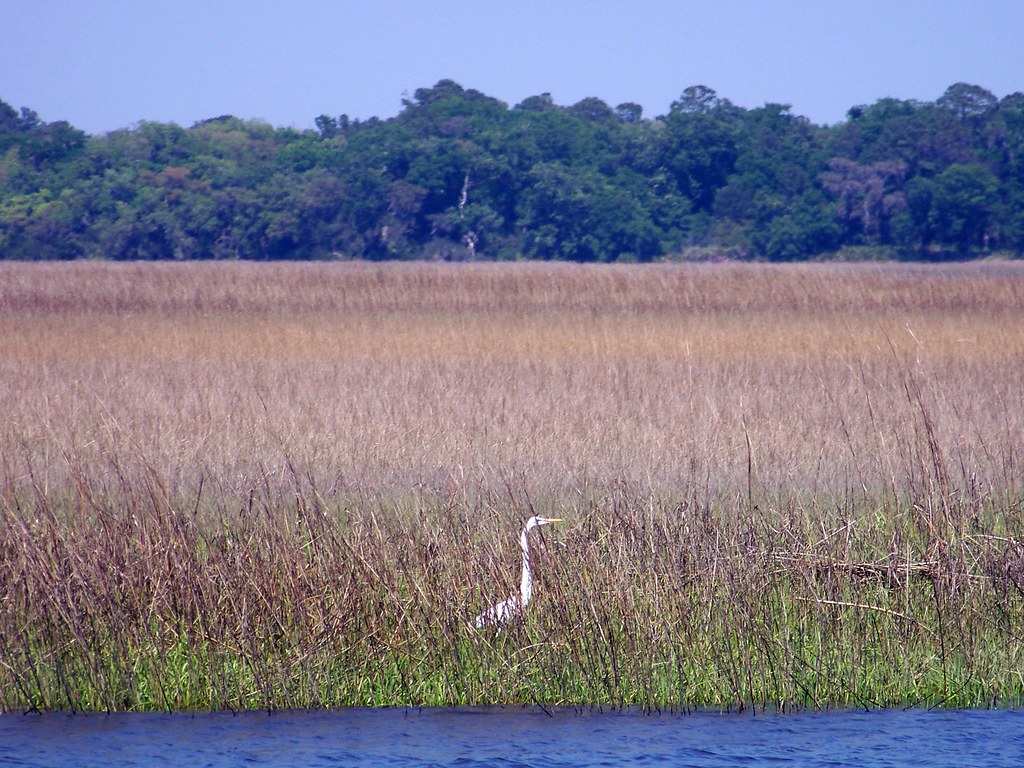
Some sources claimed that the name of the river along the Florida-Georgia border derived from Spanish control of the territory, and their nearby mission, Santa María de Guadalupe. Others associated the river with an Irish St. Mary. Evidence seemed lacking for either assertion. More fascinating was its Native American name, Thlathlothlaguphka, or “Rotten Fish.” I wasn’t completely comfortable with that particular etymology either, in fact I’m pretty sure it was bogus, however it amused me so we’ll go with it.
Ontario, Canada / Michigan, USA
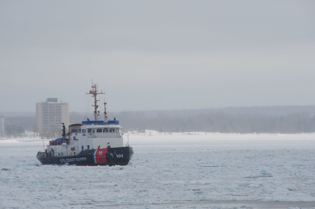
Far to the north and in a much colder climate (map), the St. Marys River allowed water to flow from Lake Superior into Lake Huron, forming a natural border between Canada and the United States. French explorers first traveled up to its rapids, thus explaining the shared names of two cross-boarder cities, Sault Ste. Marie, after the river’s French name rivière Sainte-Marie.
Some of the earliest European explorers included Jesuit missionaries such as Isaac Jogues who arrived at the rapids in 1641. Exploration by men seeking to spread their faith as much as open new lands left an impression on the geographic names that were bestowed during those early years. St. Isaac Jogues was later killed by Mohawks Indians in New York and was canonized in 1930, one of the eight North American Martyrs.
Maryland
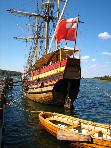
Right around the same time that Isaac Jogues explored the Great Lakes, another group focused on the mid-Atlantic coastline. Cecil Calvert, 2nd Baron Baltimore, arranged for two ships — the Ark and the Dove — and about three hundred settlers to depart from England for Maryland. The colonists arrived in 1634 and established St. Mary’s at the mouth of a river they gave the same name (map). The Maryland colony was established as a tolerant home for Roman Catholics and the initial settlement was named for Mary the Blessed Virgin.
A replica ship, the Maryland Dove, serves as a floating museum on the St. Marys River adjacent to St. Marys City.
Thus the derivation of the first three St. Marys discussed were related to three separate European nations: Spain (maybe), France and England.
Indiana / Ohio

I couldn’t find anything about the early history of the St. Marys River in Ohio and Indiana. The St. Marys and the St. Joseph joined in Ft. Wayne, Indiana to form the Maumee (map). I had better luck with Maumee. It appeared to be an anglicized name for a group of Native Americans known as the Myaamiaki. Readers are probably more familiar with another word that derived from the same tribe of Algonquian peoples, Miami.
Several Others
I discovered additional St. Mary(s) Rivers including one in Virginia, one in Nova Scotia and one in British Columbia. The US Geographic Names Information System also listed a variety of St. Marys branches, runs, creeks and even a ditch.
My favorite might have been St. Mary’s Sugar Brook (map), in St. Mary’s-The Capes, Newfoundland and Labrador (yes, with an apostrophe). That was quite a name. It sounded poetic. The brook drained from a nearby hill, St. Mary’s Sugarloaf, allegedly the “428th highest mountain in Newfoundland and Labrador” at 242 metres / 793 feet.
Leave a Reply