Virtual Traffic Circle

Traffic circles or roundabouts are a common design that circulates traffic safely and efficiently through intersections. They are a primary choice in many parts of the world. Nonetheless, they are much less common in the United States. Many American drivers tremble in fear when encountering one. That is the exact situation experienced this week by commuters and tourists in Washington, DC.

Well, at least according to a June 16, 2010 article in the Washington Post.


An Awful Intersection

Dave Thomas Circle 2010. Photo by Tom Bridge (CC BY-ND 2.0)
NY & FL Ave., a.k.a., “Dave Thomas Circle”

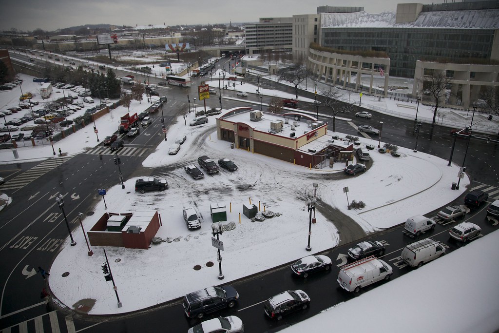
Legendary traffic bottlenecks form at the intersection of New York and Florida Avenues in the northeast part of the city (map). This is a product of the original city design, where diagonal avenues overlay a traditional grid. It may have been an innovative concept back in the early Nineteenth Century when people got around on horseback, and I suppose even today for the fans of the numerous pocket-parks formed by all those crazy intersections. Unfortunately, it’s not so wonderful for modern automobile traffic.


A New Solution

Traffic engineers responded by creating a virtual triangular-ish traffic “circle”. Thus they incorporated First Street and D Street into a rotary design. Traffic on New York Avenue still goes in both directions so it’s Florida Avenue that experiences the greatest impact as it spirals into the vortex. It’s hard to tell exactly. It all looks rather confusing, and maybe that’s the problem.

Intersection of New York and Florida Avenues, Washington, DC. Image by DC Department of Transportation
Source: District of Columbia Department of Transportation

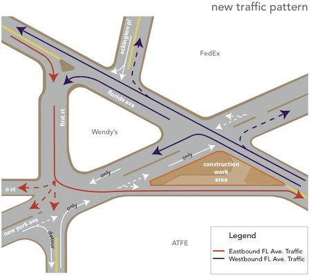
Commuters will figure out the new pattern rather quickly through daily use. Meanwhile, tourists will continue to suffer for awhile. New York Ave. carries the U.S. Route 50 designation and it’s a major approach into the city for drivers coming from the east.

This will create a particularly onerous situation for people who rely too heavily on Global Positioning System (GPS) technology. It will take several months for the new pattern to filter into electronic maps. It’s going to cause problems until that happens.

Are there similar virtual roundabouts elsewhere?

Comments

4 responses to “Virtual Traffic Circle”

  1. Richard Avatar
    Richard

    This kind of virtual roundabout, as you call it, is fairly common in the Boston area, where streets in a complicated “square” are one-way to form an effective traffic circle. Union Square in Somerville is a good example, where Somerville Ave and Bow St form an effective circle; Prospect Ave, Webster St, and Somerville Ave form another, less obvious one on the southern side of the square.

    Harvard Square in Cambridge is also an example, but it’s far more complicated (as anyone from out of town who’s tried to drive through it will tell you).

  2. Joel Avatar
    Joel

    Another Boston example is Roslindale Village which works pretty well. North of Boston is the Drum Hill pseudo-rotary from hell, which used to be an actual one.

    And maybe I’m going off-topic here, but here’s a recent post on the many “Squares” of the Boston area. I want to get a poster of this for my (Cambridge) wall 🙂

    1. Twelve Mile Circle Avatar

      @Joel: Not off topic at all. I’m a fan of Cartogrammar and I thoroughly enjoyed that post as well.

  3. Lincoln Ho Avatar

    I wouldn’t really call this a traffic circle with the complexity of the intersection, two ways, and the Wendy’s in the middle of it all! What a nightmare.

Leave a Reply

Your email address will not be published. Required fields are marked *

Latest Comments

  1. Technically it’s not always correct to say EST/CST, etc…. but just an indication that I’m changing time zone is enough,…

  2. In general, I wonder why navigating from the Atlantic Ocean to the Black Sea doesn’t count as inland navigation.

  3. Re: East/West Carroll parishes, you’re close, but the real reason for the split was more political than demographic or cultural.…