
I’m always on the lookout for odd town names. So that’s what drew my eye to a dot, the aptly named County Line, Alabama.
I wish I could make a better map, however Google seems to be stripping features away from “old” Maps, and the newer version is even worse. I can’t do simple things like customize the size and placement of embedded images anymore.
The actual county line ran diagonally through the town of County Line. It stretched from northwest to southeast, right along the hypotenuse of that strange little doughnut triangle surrounded by the town. Jefferson County fell to the left (including the triangle) and Blount to the right. Incidentally, Mob Rule’s Google Maps with County Lines was extremely helpful for this exercise and keeps getting better and better. Go ahead and type County Line, AL into the query box there and the situation will become obvious.
The Search is On
Naturally, that began a 12MC quest for additional places named County Line. However, the general Intertubes wouldn’t be much help this time. There must have been a billion barbecue joints named County Line BBQ or something similar. I couldn’t find a plausible reason either. Maybe the wording reflected a quaint faux-nostalgia comfort for residents of the lower latitudes of the United States. Perhaps something akin to emotional combinations like Biscuits and Gravy or Cracker Barrel?
Oh look, there’s one now:
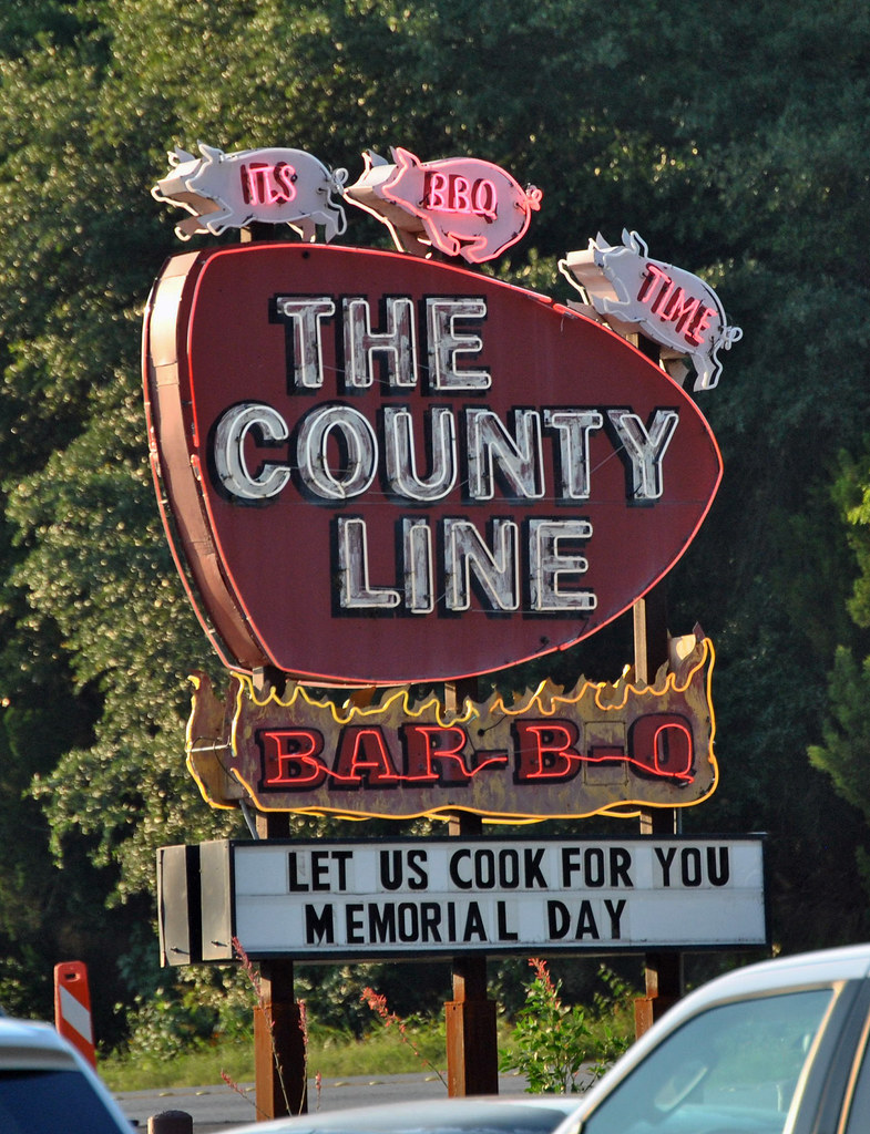
This led to my reliable standby, the Geographic Names Information System. Unfortunately it wasn’t much help either because it generated 510 County Line results. I learned that lots of churches and cemeteries considered County Line to be a fine name too. One could dine on County Line Barbecue during the week, attend County Line Church on Sunday, and rest in peace at County Line Cemetery. Continuous feeding on County Line BBQ causes clogged arteries and stokes, I guess.
That’s deliberately facetious. GNIS of course included an option to list only Populated Places. That dropped the selection to 26 sites including historical locations. I discarded those and generated a manageable handful.
The Results
After all that, I discovered… the Alabama instance I found at the very beginning was probably the best. There were others, and I’ll get to those in a moment, although County Line in Alabama was the only incorporated town and it had at least 250 residents. The rest were rural crossroads, if that.
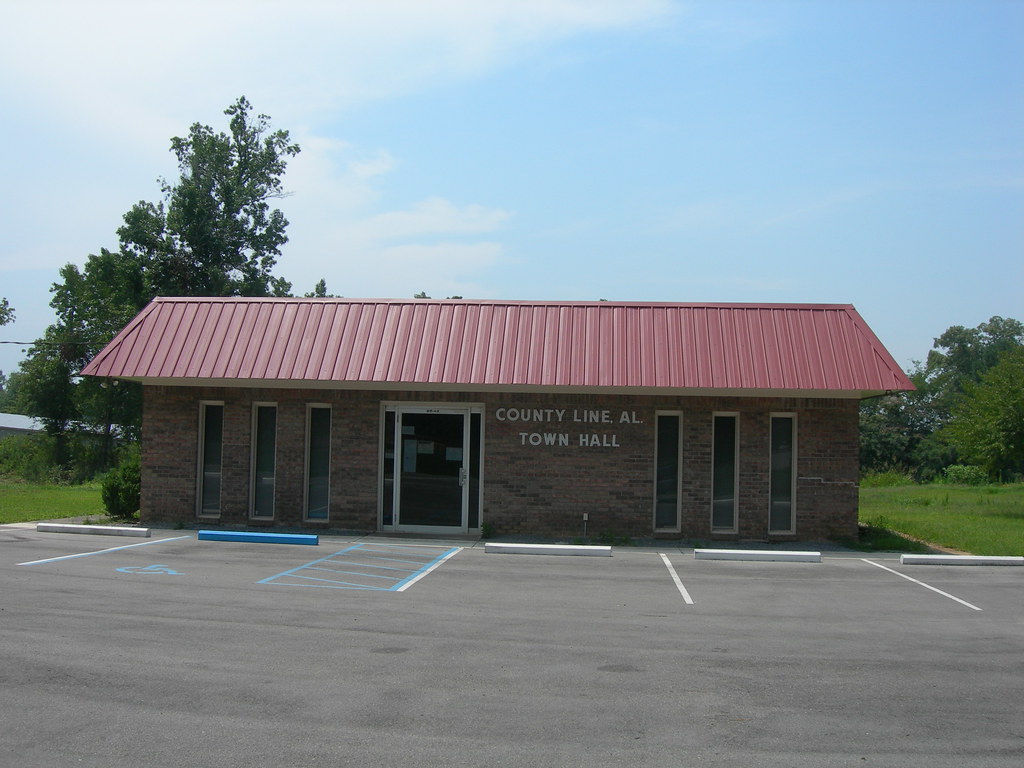
But I never claimed it was a large town, just an incorporated one. Notice the size of the town hall and it becomes self-evident. The Fire Marshall will only allow 40 people in there at a time, strictly enforced, as happened during the landfill protests of 2011.
The Landfill Protests!
That was the biggest thing to ever happen in County Line, Alabama. Combine small town politics, family friction, and large cities running out of garbage dumps, and it had the makings of an ugly fight.
From March through June that year, news sources recorded unsavory details in a series of articles. “Residents along Jefferson County-Blount County line protest proposed landfill,” then “County Line Council approves landfill,” leading to “Angry residents seek way to block proposed County Line, Alabama landfill,” and finally “County Line, Alabama, landfill hearing on for Monday” as the story petered out.
It was a family affair, quite literally. John David Calvert owned a 219-acre parcel that he hoped to convert into a landfill. So he aligned with a group of speculators called Thornhill Marion Properties. The parcel had been annexed by County Line only the previous year, which according to those opposed to the landfill, was a deliberate attempt to eliminate opposition. That made it a town issue instead of a county issue. That way neighbors living next to the proposed landfill in immediately-adjacent unincorporated areas couldn’t prevent it. Pretty slick.
Did I mention that John David Calvert’s cousin James Larry Calvert was mayor of County Line? Or that “all but one member of the town council [was] connected to the Calvert family, and three of the five council members [were] appointed by Mayor Larry Calvert, since three elected members resigned”?
Before getting too outraged, understand that the primary landfill opponent was Sue Calvert, another cousin. Apparently there were numerous interrelated Calverts in and around County Line, turning this into a family spat as much as a local political ploy.
The issue became moot later that summer when Alabama, finally tired of being a dumping ground for other States’ trash, put a statewide landfill moratorium in place.
What about the other County Line Settlements?
Two other County Lines befitted minor footnotes, one in Oklahoma (map), actually named Countyline (one word) and one in Wisconsin (map). However, they both seemed inconsequential unincorporated areas with maybe a few buildings, and in the Oklahoma instance, mostly abandoned.
The others were even smaller.
- ARKANSAS, Fulton Co. / Baxter Co. (map): It was a little east of the county line (quarter mile) and intersected by State Line Road, which paradoxically did not run to the state line that was a couple of miles farther north.
- GEORGIA, Meriwether Co. (map): Probably a half-mile north of the Harris Co. line.
- NEW YORK: Niagara Co. / Orleans Co. (map): Definitely on the county line which ran north-south; not much more than a few houses.
- OHIO: Preble Co. / Montgomery Co. (map): Also on the county line which ran north-south; and similarly not much to it.
- PENNSYLVANIA: Montgomery Co. / Bucks Co. (map): A solid example in the suburbs with the county line running northwest-southeast; not as much a distinct place as an artificial border extending through sprawl.
- TEXAS: Rains Co. (map): Maybe about a quarter mile from the northern border of Rains Co., although maybe only one building remains today.
May they all grow significant enough to spark their own landfill fights.
Leave a Reply