
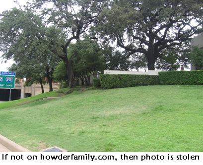
This small hillside marks perhaps the most controversial landscaping feature in modern United States history. It has been linked inextricably with shadowy figures and sinister secrets. It is the infamous Grassy Knoll.
President John F. Kennedy rode directly past this spot when gunfire ended his life on November 23, 1963. Depending on the evidence one chooses to accept, one or more additional conspirators may have perched here on that awful day.
From the Street
This is a Google Streetview of the motorcade location, looking back towards the Texas School Book Depository. The presidential motorcade had just turned left from Houston Street onto Elm Street and traveled down to this approximate spot. Notice the clear and direct line of sight from the right corner window of the sixth floor where Lee Harvey Oswald fired his rifle. Rotate the image to get a sense of the entire Dealey Plaza area.
The Grassy Knoll was directly to the right and above the President as the motorcade drove past. It was also near here where Abraham Zapruder recorded his famous film. The limo then sped through the underpass towards Parkland Memorial Hospital.
Texas School Book Depository
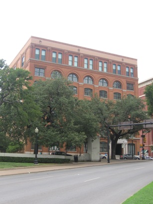
This is an image of the School Book Depository that I took from Dealey Plaza. I’ve been to Dallas a few times but this was my first visit to the spot of the JFK assassination. What struck me was how closely the key spots clustered amongst themselves. I had imagined much greater distances in my mind’s eye.
Seeing it in person, I realized that six stories is much lower than I imagined and the distance down Elm Street was much shorter. The Grassy Knoll itself was just a few feet away from the street.
It was a bright, sunny, ninety-five degree day when I visited. Nonetheless, I felt chills.
Leave a Reply