
Speaking of the Outer Banks of North Carolina — we were just talking about that, right? — that’s where I happened to be visiting for an extended weekend. I don’t get to do that very often so this was my chance for our own little episode of Weekend Roady. I love going to the beach in winter when crowds are down and everything relaxes. However, I hadn’t been to the Outer Banks (map) since I was a little kid. It was way overdue.
To the Beach
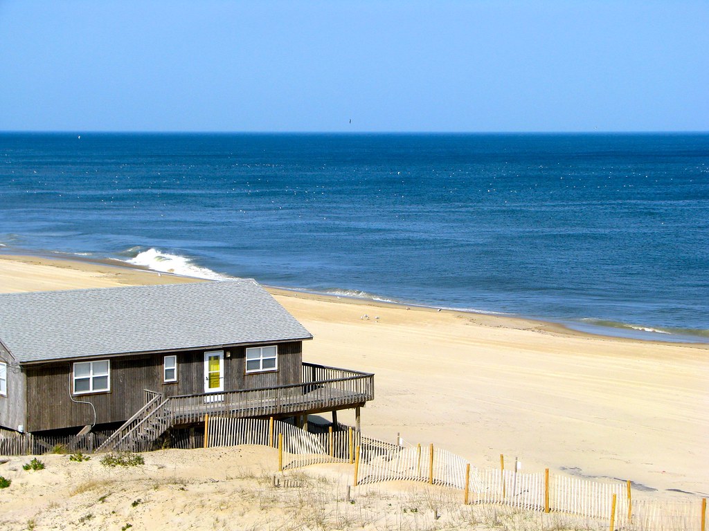
We had a day of sun, a day of clouds, and a day of intermittent rain. It was like having three completely different mini-vacations. This was the view from our room in Nags Head on an unseasonably sunny and warm 75° f. (24° c.) afternoon. The other great thing about traveling off season: I wouldn’t want to consider what this view might cost during summer. It’s completely affordable in the winter though.
Fort Raleigh National Historic Site

The Outer Banks contain more than its share of history crammed into several National Park Service properties. The Fort Raleigh National Historic Site (map) is located on Roanoke Island at the confluence of Albemarle and Pamlico Sound.
I think most of us know the story. The Roanoke Colony would have been the first English settlement in North America, having been established 1587, but its inhabitants disappeared mysteriously before a supply ship returned in 1590. There are many theories purporting to explain the demise of the Lost Colony but nobody knows for sure. Even the exact location of the settlement isn’t definitive although the Park Service has reconstructed an earthen fortification like what may have existed originally.
Wright Brothers National Memorial

A much more successful “first” happened a little further north in Kill Devil Hills (map; Kitty Hawk is nearby). The Wright Brothers first flew an aircraft here under its own power in 1903. They had been experimenting with gliders on the dunes and using their knowledge to construct a motorized aircraft. The very first flight was brief; only twelve seconds. Notice the large rock next to the shed. That’s where the airplane took off. The craft made it to the smaller stone near the right side of the image. The second and third flights that day covered similar distances. The fourth and final flight went considerably farther, several hundred feet.
Cape Hatteras National Seashore
Down the sandy chain we drove, through long stretches of Cape Hatteras National Seashore (map). Cape Hatteras Light with its iconic spiral stripes of black and white serves as an unofficial symbol of the Outer Banks. It rises 200 feet (61 meters) above this very dangerous cape, the epicenter of the so-called “Graveyard of the Atlantic.” The tower was closed for the season but that was fine because I had a different destination further south in mind.
Hatteras Inlet Ferry
We arrived at the ferry terminal to take us to Ocracoke Island a few miles later. This is a great bargain, a 40-minute ride across Hatteras Inlet (map) for free! It wasn’t a hassle even though the ferry runs only once per hour during winter months. We drove up to the dock a few minutes before departure at the top of the hour, rolled right onto the ship and took a little cruise. The return crossing was a bit more “interesting” with a garbage truck parked in front of us and a porta-potty truck parked behind us. Thank goodness for moderate temperatures. Plus, a day on the sea beats a day in the office, right?
Ocracoke Island

I really wanted to see Ocracoke Island so I’m glad the ferry worked out. No bridge connects Ocracoke to the mainland or to the rest of the Outer Banks so there aren’t many options. It has a single small town at the far southern tip of the island; the remainder all falls within the National Seashore. One drives a dozen-or-so miles from the ferry terminal to town along an asphalt ribbon through remote dunes and tidal estuaries. History holds that Blackbeard the pirate frequented the area and that he died on Ocracoke. The drive evokes a remote, timeless feel.
The town of Ocracoke is a throwback to what the rest of the Outer Banks probably looked like a half-century ago before all the motels and weekly rental homes took over. It’s a great place to walk or bike along narrow streets and amongst quaint cottages. Certainly tourism underpins the economy but the lack of a bridge has allowed it to escape the bulk of the tackiest aspects.
I hit a lot of things I like count on this trip: some new lighthouses, a couple of brewpubs, a few counties to count, a fortification and a ferry. That’s not bad for a long weekend.
Leave a Reply