
The border between the United States and Mexico has been a frequent topic of news and conversation this summer. But let’s be clear; Twelve Mile Circle doesn’t generally focus on political issues. Even so, it does have an interest in situations created by geography such as the recent border pirate phenomenon. In fact it was that situation that led me to the current topic, although indirectly.
Something Unusual
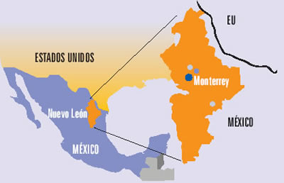
I noticed something unusual as I examined the international border between Laredo, Texas, USA and Nuevo Laredo, Tamaulipas, Mexico. There is a nub on the northern end of Nuevo León if one looks closely. The little chunk inserts itself along the international border, wedged between Tamaulipas and Coahuila.
This little neck is only about 15 kilometres (9 miles) wide and not much longer. However, that’s enough to make Nuevo León one of ten “border states” found on either side of the line. It as legitimate as Texas and its 1,997 km (1,241 mi) stretch.
Looking Closer
It’s much easier to see the notch when drilling down into an interactive map to capture it in more detail. Follow the international border northwest out of Nuevo Laredo and it practically jumps from the image. This would be an easy pickup of three Mexican states right in a row for those who collect such things. Additionally, Tamaulipas and Coahuila almost qualify as neighboring states. Unfortunately, that odd Nuevo León hernia interferes with their abutment.
Drill down on the protrusion and an unusual pattern of roads appears. The small town of Colombia follows a typical grid. Yet, the infrastructure southeast of it seems odd. That’s because its a staging area for international trade between the United States and Mexico. So, it’s more suited to warehouse space and tractor-trailers than to residential neighborhoods. Remember, Nuevo León is a highly-industrialized powerhouse of the Mexican economy. It has a per capita GDP and income nearly double the national average. They use their little border nub to move products onto the international market.
Amazingly this didn’t happen until the early 1990’s with the construction of the Laredo–Colombia Solidarity International Bridge. Nuevo León watched idly as other border states cashed-in for years. Adjacent Tamaulipas positioned Nuevo Laredo as the most important border crossing in Latin America, and the city thrived as a result. Finally Nuevo León got its bridge to the United States. Then it created infrastructure around the town of Colombia to capture some of that cross-border trade.
The Notch
I don’t have a complete answer on how Nuevo León obtained its border notch. Neither do I know how neighboring Tamaulipas got its odd northwestern tentacle along the river. However, I think I might have at least a partial answer. Or maybe it’s closer to an educated guess.
I consulted the website of the ever-helpful Perry-Castañeda Library Map Collection of the University of Texas at Austin. Deep down on one of its menus lists I found a map of Mexican political divisions in 1824, created from historical sources in 1972. Let’s assume it’s an accurate representation. Given that, Nuevo León got its river notch at least two centuries ago. Tamaulipas got the odd appendage because the northern third of its 1824 footprint — everything north of the Rio Grande — became Texas.
That doesn’t answer why Nuevo León has river access. It merely points out that it’s been that way for a long time and predates the international border. It’s an arid area with very little rainfall so maybe the notch existed as a pathway to water. I’m speculating but I don’t know. Perhaps someone in the Twelve Mile Circle audience has greater familiarity with this topic. Maybe they can use the comments section as an educational opportunity.
Leave a Reply