Every once in a great while, whenever I get a little curious and begin to wonder, I go back through my older web logs and see if I’ve recorded any more first-time international visitors. This is becoming an increasingly unusual discovery. I’ve been running Google Analytics for two-and-a-half years. Almost all sovereign nations of any size, shape or location, and even some that would seem to highly unlikely, have thrown at least one visitor over my transom.
African nations provided all four of my new additions during the Spring of 2010. That’s a great thing. I’ve struggled to attract more visitors from Africa for the longest time. I do get a decent amount of traffic from South Africa including a few regular readers who subscribe to the blog on RSS. However, I still haven’t managed to resonate much with other readers from the continent. I continue to find it difficult to post geo-topics that might interest an African audience.
Mauritania

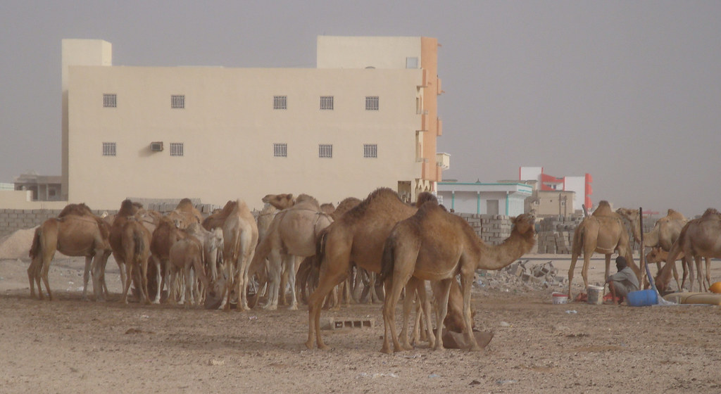
Nouakchott is the capital and largest city in Mauritania (map). This is a hot, dry locale although it’s not quite as extreme as some other cities in the region thanks to steady breezes that originate on the nearby Atlantic Ocean. The city has a deepwater port and serves as a trading gateway into Western Africa.
I have absolutely no idea why my visitor had an interest in an obscure Midwestern family and its mundane dealings between June 7 and August 21, 1903. This page comes from the genealogy side of my website and it would probably interest only the most dedicated band of hard-core sociologist or researcher.
Then I think I figured it out. It talked about tea parties. The viewer might have been searching for information on the recent Tea Party political phenomenon in United States. Perhaps they’re a friend of this blog’s (theoretically but highly unlikely) most famous reader.
Sierra Leone

I have a definite soft spot for Sierra Leone because of a gentleman I knew from that West African nation. We toiled together as we pursued our graduate degrees many years ago.
I’m glad I finally managed to attract a visitor from Freetown, its capital city (map). Freetown was founded in 1787 by freed slaves relocated from the Americas with support of British abolitionists. I just learned that tidbit. That’s really cool. I probably should have guessed it if only I’d pondered the derivation of the city’s name. I’m more familiar with the story of Liberia, its neighbor, but I digress. Today Freetown is a city of a million people so I suppose it’s safe to conclude they succeeded.
However, I cannot figure out for the life of me why this first-time visitor cared that Arizona does not recognize daylight saving time. Maybe they were contemplating a trip to the Grand Canyon this summer? That seems really tenuous.
The CIA World Factbook estimates only 13,900 Internet users in Sierra Leone (as of 2008). This one was a good catch.
Zambia

My next new visitor came from Lusaka, Zambia (map). Nearly a third of the Zambian population lives in this capital city. Once again it’s not too surprising that my initial voyager came from the settlement with the preponderance of infrastructure and economic resources. The name Zambia derives from the Zambezi River, a vital connection to the outside world in this landlocked country.
So why were they interested in John Harvard’s Brew House, a small brewpub chain clustered in the northeastern United States. Did the Harvard thing confuse them or was they truly aficionados of craft breweries?
Namibia

Finally, I received a virtual guest from Namibia who geo-located to its capital city, Windhoek (map). A big chunk of Namibians reside within that single locale and once again we find a situation where disproportionate amounts of financial resources and infrastructure focus on the capital. Windhoek would be the most likely place to send a Namibian Internet visitor my way.
South Africa controlled Namibia for much of the Twentieth Century up until 1990. So I’m a little surprised that it took this long to record a tally on the website simply because of cultural similarities between the privileged elites that would most likely have Internet access.
My Namibian visitor searched for “cartography” on the Twelve Mile Circle blog. This viewer might be someone with a true appreciation of odd geography. I can only hope, can’t I? I’ve since recorded other Windhoek visits which seem to support that assertion.
Slowly the map fills-in.

Leave a Reply