
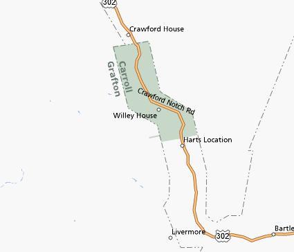
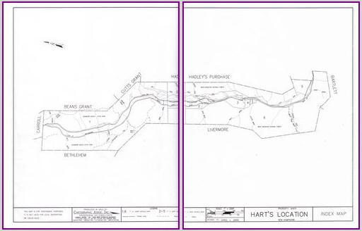
Crawford Notch (map), and its primary community Hart’s Location, form an 11 mile by 1.5 mile protrusion outward from the northwest corner of New Hampshire’s Carroll County (see my previous entry on the irregular borders of Carroll County).
However, it’s not a worthless appendix. It provides an important passageway through the White Mountains as it wriggles its way along the upper Saco River valley. Early explorers and settlers, then railroad barons, and later automobile travelers all coveted this steep gorge. They found it an efficient passage through rough terrain.
Elections
The gorge is more than just a geographical oddity. It’s also a political oddity. When New Hampshire presidential primaries and general elections take place, the residents of Hart’s Location compete with other small towns such as Dixville Notch in a race to cast the first ballots.
New Hampshire law prescribes polling hours. However, when every registered voter in town casts a ballot before the official closing time, the town can legally close its polls and announce results.
That’s not a difficult feat for Hart’s Location and its 40 residents. It’s something they’ve done frequently since beginning the tradition in 1948. The news media frequently covers these events and publishes the results.
Hart’s Location
Hart’s Location was once truly a “Location”. That’s a legal designation in New Hampshire. The state uses it to describe an area of limited self-government that is not part of an established town. Today, however, Hart’s Location is no longer a Location according to the official definition. The town incorporated and has the distinction of being the very smallest of the state’s 234 towns and cities.
There is significance here extending beyond a strategic passageway and a political bellwether. It also served as the site of an historical event called Willey’s Slide. Sam Willey and his family died in an 1826 landslide after they left their home in an attempt to seek more protective cover. Ironically the landslide spared their house. This is a geography blog not a politics blog so I’ll leave that thought for others to ponder as the elections approach.
UPDATE January 8, 2008: The Associated Press reported this morning that Obama and McCain have carried Hart’s Location. “In Hart’s Location, Obama received 9 votes, Hillary Rodham Clinton 3 and John Edwards 1. On the Republican side, McCain received 6 votes, Mike Huckabee 5, Ron Paul 4 and Mitt Romney 1.“
Leave a Reply