
We finally began our trip to West Virginia after a two week delay. It made all of the difference. Springtime arrived and the weather approached perfection. My older son — the bird watcher, map aficionado, self-taught student of the Norwegian language — joined me on my inexplicable county counting odyssey. I did capture the remaining West Virginia counties by the way although I’m getting ahead of myself. Then I updated my map accordingly.
The initial day focused squarely on placement. I didn’t cross any new borders and I didn’t even try. I simply wanted to get to Parkersburg to aligned ourselves properly for days 2 and 3 when the real work would begin.
First, however, I had to blast through the western edge of Maryland. That meant Interstate 68 via one of my favorite geological formations, the awesome road cut at Sideling Hill. I thought back to what reader Jody Stottlemyer mentioned a couple of weeks ago: “When [you] drive through Sideling Hill on 68, give a wave east toward the little church on the hill– that’s us.” We paused at the rest stop atop the hill and I saw only one church from up there. Jody, if that was you maybe you noticed someone waving in your general direction sometime around noon on April 20?
Casselman Bridge/Stanton’s Mill
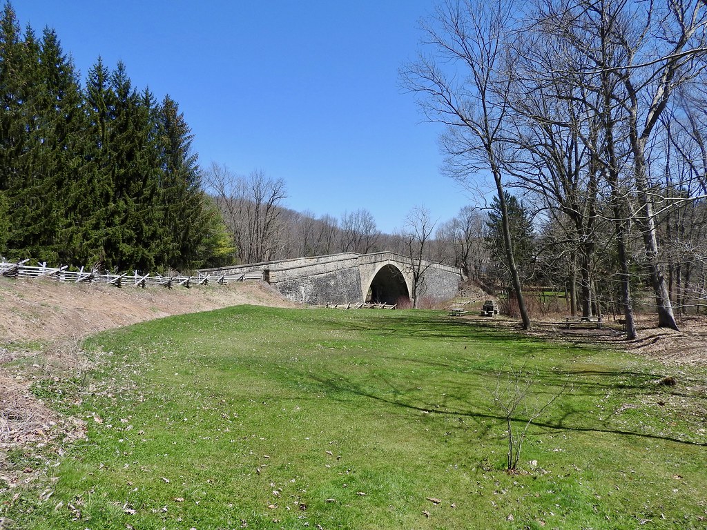
Still in Maryland, almost to West Virginia, I wanted to check out a bridge constructed in 1813 for the old National Road. It served as the centerpiece of tiny Casselman River Bridge State Park, preserving the structure in perpetuity for its historical significance. The National Road helped open the western frontier of the new United States to settlement, with engineering marvels unseen on the continent before that time. No other stone arch bridge included a longer single span anywhere in the US at the time of its construction. We paused for lunch and enjoyed the view.
This stop also included a couple of bonus sites. The Casselman River powered Stanton’s Mill, still grinding grain into flour much as it had since 1859. Demonstrations took place during summer months so we arrived a little too early in the season to watch it in action, so I settled for an exterior photo instead. Another attraction, the Spruce Forest Artisan Village occupied the same basic site. Resident artisans sold their crafts from old log homes moved to the site from all over western Maryland. I would like to return again someday when I have more time to explore.
Hovatter’s Wildlife Zoo
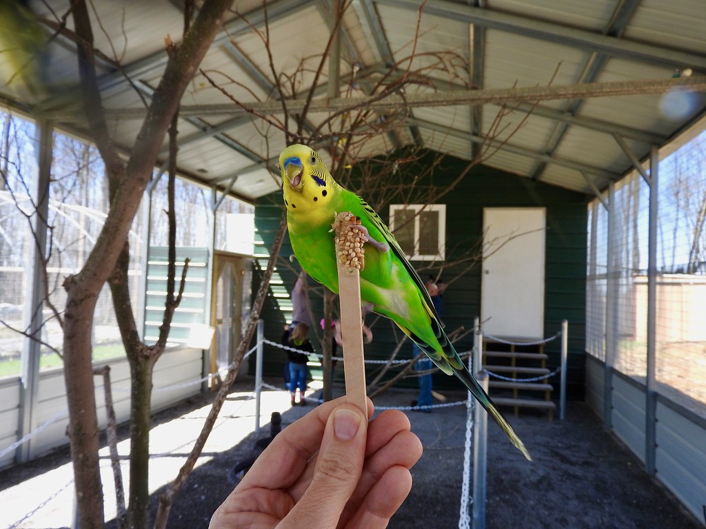
The entire trip couldn’t be totally about my county counting or other whimsical obsessions. I had to bribe my son with something he would enjoy too. He loves zoos and fortunately I found one not too far from our intended path. In fact he counts his zoo visits like I count, well lots of different things. Genetics works in strange ways. Anyway that brought us out to Kingwood, West Virginia. Our two-week delay turned out to have a silver lining. Hovatter’s Wildlife Zoo would have been closed if our original plan had unfolded as intended. The zoo opened for the season just a few days before our revised arrival.
Few other visitors roamed the park with us on this chilly early-season Friday afternoon. We toured each of the exhibits at a leisurely pace without being disturbed. This wasn’t a particularly large zoo so we finished it in about an hour and went on our way. My son thoroughly enjoyed his time there so I’d call it a success even if zoos really aren’t my thing.
From there we returned to Interstate 68 just east of Morgantown and focused on mileage.
Fort Boreman Historical Park & Overlook

From Morgantown we followed major highways over to Parkersburg, from I-68 to I-79 to US Route 50. We focused on the shortest, fastest route possible because, again, I didn’t plan on capturing any counties that day anyway. I simply wanted to get to Parkersburg as quickly as we could so we’d be ready for the main event the following morning.
I’d only ever driven through Parkersburg before so stopping overnight let us experience it at something less than highway speeds for once. I stopped first at Fort Boreman Historical Park on a promontory above the city. During the Civil War, right after West Virginia split from Virginia, the Union army thought it needed to fortify the confluence of the Ohio and Little Kanawha Rivers.
Soldiers built Fort Boreman in 1863 and occupied it for the remainder of the war. Peacetime brought obsolescence so the army decommissioned it and the site fell into decay. A century later the city of Parkersburg gained title to the land and created a park. Now anyone can drive to the top for some amazing views of the city and its rivers.
Parkersburg Brewing

That was a long day with lots of driving. I figured I earned a beer so we checked into our hotel and headed to Parkersburg Brewing for dinner. Naturally I’d selected a hotel just a short two-block walk away from the brewpub.
We went to bed early that night so we’d be ready for the big day to follow, with dreams of Mothman in our heads.
Articles in the Finishing West Virginia Series
See Also: The Complete Photo Album on Flickr
Leave a Reply