
Take a look at the shape of Denver, Colorado. You’ll notice an unusual appendage branching out from its northeast corner. Denver represents one of those infrequent hybrid situations where a city and a county combine to form a single entity within a common border. As a consequence, sometimes Denver acts like a city and sometimes it acts like a county. Naturally, that can lead to interesting impacts on the local geography.

These are the neighborhoods of Denver. Now notice the appendage in question at the upper-right. The purpose of the appendage presents itself readily: it surrounds Denver International Airport.
The Airport
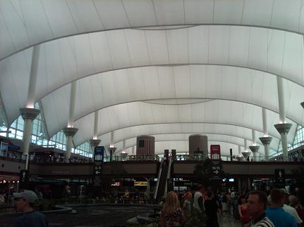
I’m in Denver this week as you may have already guessed. Well this is the terminal at Denver International Airport, squarely within the boundaries of the combined Denver City/County. Adams County surrounds the airport on all sides except for a corridor that connects the facility with the remainder of Denver.
Annexation
The land occupied by the airport used to be part of Adams County. It’s annexation to Denver happened only recently. Apparently Denver’s split city/county personality favors its city side when it comes to expansion plans. They had a nasty habit of grabbing land from surrounding counties until the State of Colorado stepped in. They passed legislation that blocked further expansion without approval from voters in the jurisdiction that stood to lose acreage. Even that didn’t halt expansion entirely.
The Colorado General Assembly authorized a vote in 1987 that would transfer the airport land to Denver if approved. The voters of Adams County approved it in 1988, and Denver City/County did likewise in 1989. Title passed to Denver and its territorial dimensions increased by 45 square miles. Very few county boundary changes happen in the Lower 48 United States anymore. So count this among the rare instances, on quite a remarkable scale to boot.
Debunking Conspiracy
I’ve not been able to find a good explanation for why the voters of Adams County were amenable to ceding a big chunk of their territory. I can only find odd conspiracy theories on the Internet (along with a good debunking). If anyone knows the full story, please let me know in the comments section, below. I’m going to guess that maybe Adams County thought it would be a tax drain or a pain to operate.
I’m surprised the story isn’t more readily apparent since it’s practically a current event. Maybe it’s simply drowned out by the background noise of the conspiracy chatter. Adams County does have a recent history of losing territory though. It also lost a small parcel during the formation of Broomfield County in 2001. Maybe it’s just unlucky.
Another Oddity
There is one additional odd feature. Great pains were taken to append the airport to Denver’s territory but the corridor isn’t contiguous with the major road infrastructure. I think it might be possible theoretically to get from downtown Denver to the airport without ever leaving Denver City/County. However, that would involve neighborhood streets. The most direct route leaves Denver and clips Adams Co., as confirmed by road signage I noticed along the route yesterday afternoon.
Also I have a couple of other Denver geo-oddities in mind. Hopefully I will hit at least one of them this week. As usual, I have only a brief window in the evening after meetings that last the entire day. We’ll see how it goes.
Leave a Reply