
Several years ago, way back in November 2009, Twelve Mile Circle published an article called Counting Border Crossings. It revealed a new way to track travels suggested by loyal reader Jon Persky. Many people count nations, states, provinces, département, territories, counties or whatever. Jon’s method counted a place only when an adventurer traversed each border that it shared with every one of its neighbors. Refer to that original article for additional explanation.
It’s not that complicated. Anyway, his analysis resulted in a comprehensive map of possible crossings for the internal state-level divisions of the United States.
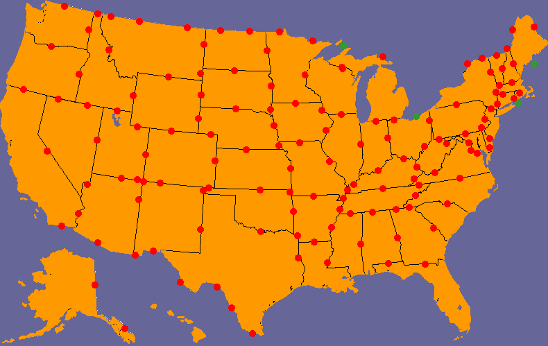
The map included crossing between individual states as well as with provinces of Canada and states of Mexico. Some efforts could be completed only by ferry as designated by green dots.
Progress
I seemed smitten with the concept at the time and I vowed to track my personal progress. Then I promptly forgot about it until I stumbled upon that old article a few days ago. However, I still loved the premise and I decided to update my personal map. This is how it looks now.
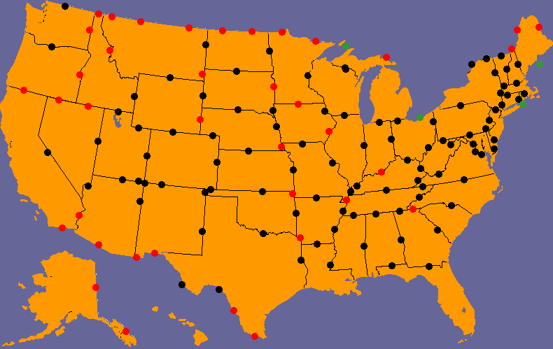
In 2009 my tally stood at 75 crossings with only 6 states completed. My 2016 results improved to 95 crossings and 17 states completed without any conscious effort. I said at the time, and I still agree, that “this game is insidiously difficult… players have to cover large distances to complete even the smallest of states because the object is to work the perimeter.” Many possibilities will also remain uncounted on my map until I take a lot more trips into Canada and Mexico.
Those Geography-Based Running Trips
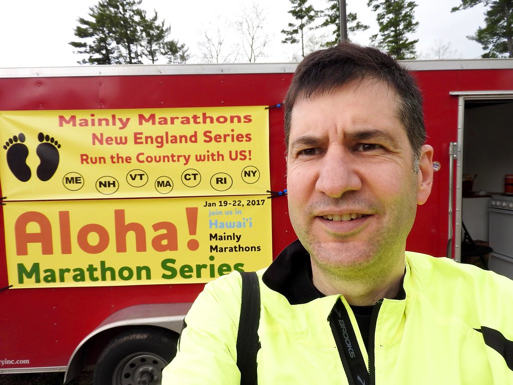
The secret to my success happened by happy accident as I chauffeured a participant through several Mainly Marathons race trips. Longtime 12MC readers probably remembered the premise. These races catered primarily to a very specialized subset of marathoners who wished to complete a course in all 50 states. Other runners had completed literally hundreds of marathons and simply wanted to increase the lifetime totals. My participant specialized in half-marathons and insisted she was only “half crazy.”
Each series featured back-to-back races in different state on subsequent days. For example, the New England Series that I wrote about in May included seven races in seven days in seven states (Maine, New Hampshire, Vermont, Massachusetts, Rhode Island, Connecticut and New York). I’d also served as driver for other races including the Center of the Nation, Riverboat and Dust Bowl series.
All told, those races involved 23 separate states. The whole premise of race site selections focused on minimizing driving distance while crossing between numerous states, a perfect combination for Jon’s concept. How else would I reasonably expect to find a reason to cross between New Mexico and Oklahoma, as an example?
Shhh… don’t tell anyone. I actually started running the 5K’s each day beginning with the Center of the Nation series. That made me about 12% crazy by my calculations. It was the only way I could stop eating piles of snacks at the aid station as I waited for my runner to finish.
I Loved the Tripoints

Back then I said, “I haven’t even completed my own home state of Virginia where I’m missing its border crossing with Kentucky and I doubt that I’m going to get this one anytime soon.” I couldn’t have been more wrong. Immediately thereafter I began an effort to capture every county and independent city in my beloved Commonwealth, although the effort lasted several more years. However, for this purpose, the quest drew me to the isolated counties at the far southwestern corner of Virginia. There I crossed the Kentucky-Virginia border at the KYTNVA Tripoint in 2013.
Other tripoints offered additional border crossing opportunities. I crossed Massachusetts-New York for the first time at the CTMANY Tripoint, thanks to Steve of CTMQ. I also leveraged an amazing three tripoints on the Dust Bowl trip for additional first-time crossings; Colorado-Oklahoma at CONMOK, New Mexico-Oklahoma at NMOKTX and Colorado-Kansas at COKSOK.
Favorites

A couple of new crossings stood above the rest. Kentucky-Missouri might have been the best. These two states shared a very short border along the Mississippi River. Anyone looking at a map would see that no road crossed the river anywhere between them. However, a dry-land border still existed! The river shifted at some point leaving a small part of Kentucky stranded on the Missouri side (map). It retained the curious name Wolf Island even though it wasn’t an island anymore.
I found a gravel road leading to a pasture where I could cross from Missouri into Kentucky via Wolf Island. An hour later I crossed between the two states again, this time over the Mississippi River on the scenic Dorena-Hickman Ferry (my video). I felt proud that I completed the border crossings using the only two means available, both of them creative and completely non-traditional.
A second favorite might have been my crossing between Utah and Nevada. I took the family to Utah in 2011. One morning, while the family slept, I decided to drive 150 miles (250 kilometres) each way from Ogden to West Wendover, Nevada. Why? To visit the only place in Nevada that legally recognizes Mountain Time. That was completely nuts, and that’s what made it so memorable.
The Ones that Got Away
I paid a steep price when I forgot Jon’s game. A couple of opportunities wriggled away while I wasn’t paying attention. Last summer I went to Asheville, North Carolina and captured a slew of new counties. I was pretty close to Georgia and I could have snagged the Georgia-North Carolina crossing. I don’t know when I’ll get that chance again. Ditto for Nebraska-Wyoming and Montana-South Dakota when I took my Center of the Nation trip. Those may be too remote to hit without special effort, especially Montana-South Dakota. That one would require a drive over many miles of gravel road (street view). Missouri-Tennessee, on the other hand would have been an easy pickup. Alas I missed that opportunity too.
I still loved the concept. Maybe this time I won’t forget about it for several years. No promises.
Leave a Reply