
The article I discovered was more than a year old, although it was new to me when I spotted it. The title intrigued me, Did You Know: Capital Of Arizona Moved 4 Times Before Settling In Phoenix. No, actually I didn’t know that. I’ve featured similar stories of wandering capitals for other states such as Ohio, Georgia and Alabama. Why not one about Arizona capitals too? The article provided a nice overview so I could explore some of the stranger aspects and then the actual locations of its multiple former capitol buildings.
Mesilla, New Mexico

For instance, the first Arizona capital was actually located in New Mexico although not according to the United States government. The Confederate States of America had a surprisingly strong presence in the neglected farthest southern reaches of the western desert.
The New Mexico territory encompassed an area occupied by modern New Mexico and Arizona at the time. The Confederates claimed the southern half as Arizona during the Civil War, placing their eastern capital in Mesilla when troops under Col. John Baylor arrived in February 1862. No signs remain of their original capitol building. However, it stood where the historic Fountain Theater later rose in the 1870’s and still operates today (map). However, Confederate government wouldn’t last long there. Union troops drove Baylor and his rebellious forces into Texas a few months later.
Prescott

The United States government looked unfavorably upon the Confederate incursion as one might expect. Then it diluted Confederate sympathies by cleaving Arizona from the western half of New Mexico rather than the southern half. Prescott became the Arizona capital in late 1863 at nearby Fort Whipple (map), an Army base.
A few months later the capital moved into the town of Prescott proper and into more suitable accommodations. A large log building served as the seat of government as well as the governor’s home. They sold it as a private residence when no longer needed, when the capital finally wandered away to a new location for good. The City of Prescott preserved the building at its original location. Now it forms the backbone of the Sharlot Hall Museum (map).
As the museum explained,
“The log house served as both home and office for Territorial Governor John Goodwin and Secretary Richard McCormick. In September 1865, when Goodwin was elected Territorial Delegate to Congress and returned to the east, McCormick brought his new wife Margaret out from New Jersey, and he soon became our second territorial governor… In 1867, the Territorial Capital was transferred to Tucson, and Governor McCormick went with it.”
Tucson
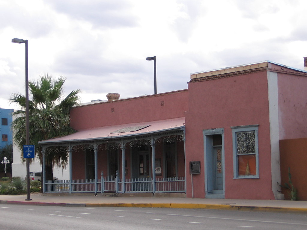
The capital would remain in Tucson for the next decade, from 1867-1877 (it had also served as the western Confederate capital briefly during the war). However, Arizona never bothered to build a dedicated structure to house the territorial government. The permanent location for its seat of government continued to remain unsettled, with political forces nearly evenly divided between choosing Prescott and Tucson.
Instead the territorial government met in several privately-owned facilities spread throughout the town at any given time, most famously the Congress Hall Saloon. I had a difficult time finding the exact location of the saloon because it was torn down in the early 1900’s. Finally I tracked the site down to a spot along one of Tucson’s major road — Congress Street (named for the saloon). The cross streets were Congress and Meyer (map) although Meyer no longer extends through there anymore.
The Congress Hall Saloon played a prominent role in the history of Tucson. Charles Brown was its proprietor, and his home still exists at 40 W. Broadway Boulevard, a couple of blocks to the east of the old saloon. Not only did the saloon serve as an informal territorial capital it also hosted an 1871 meeting “of prominent townsmen… during which the municipality of Tucson was organized and officers elected.”
Few structures of suitable size existed in an emerging frontier town. So they chose a saloon and didn’t care about the alcohol part of it.
Phoenix
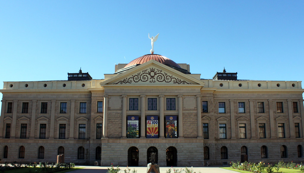
Political wrangling continued. The capital moved back to Prescott in 1877 where it remained until 1889. Finally, the legislature settled on Phoenix. This time the location stuck. They chose a compromise location about halfway between Prescott and Tucson. If politicians couldn’t decide on one town or the other at least they could stick it in the middle.
A new capitol building (map) soon emerged on the spot and remained in service until the 1960’s when replaced by the current capitol building adjacent to it. The original Phoenix structure then became the Arizona Capitol Museum.
Old sympathies died hard on the frontier and more than a few recalcitrant Confederates remained in Arizona even decades after the Civil War ended. Arizona became a state on February 14, 1912. That was fifty years to the day from when Colonel Baylor declared a Confederate Arizona on February 14, 1862, establishing its capital in Mesilla.
Leave a Reply