
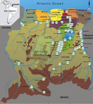
So this is Suriname. Go ahead and take a look at its shape relative to its neighbors, Guyana and French Guiana.
These are the three Guianas. They all line up in a tiny, tidy row on the northeast corner of South American along the Atlantic Ocean.
- Suriname was once Dutch Guiana, a colony of the Netherlands.
- Guyana was once British Guiana and part of the United Kingdom.
- French Guiana continues to be part of France, an overseas department (département d’outre-mer).
It’s a confusing situation. All three are the single minuscule outposts of cultures not represented elsewhere on the continent: English; Dutch and French. All three share common roots as colonial beachheads that somehow clung to this faraway land where Spanish and Portuguese interests dominated.
Then we layer cultural and historical differences upon colonial boundaries that were a bit fuzzy and somewhat subject to interpretation. It didn’t really matter much during colonial times. Back then the borders crossed through the nearly impenetrable tangle of rainforest that grew practically to the coast. However, it does matter today.
Dispute
The half million citizens of Suriname would not necessarily agree with the map as Google draws it. Never mind that Google reflects the opinion of just about every other national and international organization on the planet. Even so, someone living in Paramaribo is likely to draw it a bit differently. This is how Suriname sees its boundaries:
Take a look at the southwest and southeast corners. Notice something a little extra? Suriname believes its border with Guyana extends to the New River while others believe it follows the Kutari-Curuni River. Likewise, Suriname believes its border with French Guiana extends all the way to the Marouini River rather than the Litani River. The dispute also reaches into the territorial waters of the Atlantic Ocean. That one has been partially resolved so I won’t focus on it today. The disputed territories on land are shown on the map, below.

New River Triangle
The southwestern disputed area with Guyana, sometimes called the New River Triangle, covers a territory of 6,000 square miles (~15,600 square kilometres). This is actually larger than the U.S. state of Connecticut.
It’s a fairly recent dispute because the Corentyne River was long considered the accepted boundary. Dutch officials, starting in the 1960’s and prior to Suriname’s independence, suggested that the New River was an upper part of the Corentyne instead of just another tributary.
If the New River is actually the dominant watercourse forming the upper portion of the Corentyne River, as the logic goes, then the existing boundary line is incorrect. It should shift from the Kutari-Curuni River to the New River in Surname’s favor.
Marouini and Litani Rivers
A similar situation exists on the French Guiana border. In this instance it’s the Marouini River and Litani River which are in question. One might wonder what the bother is all about in these very remote, sparsely inhabited interior jungles. Suriname is a small nation and territorial expansion would increase both its size and stature. The genuine possibility of gold, diamonds, bauxite and hydroelectric resources probably figure into the justification as well.
I reviewed several academic and legal descriptions of the situation. The consensus seems to be that Suriname would probably lose if it agreed to arbitration under the precepts of international law. The overarching evidence supporting the cases of its western and eastern neighbors is that both have occupied and governed the disputed areas as integral parts of their sovereign territory for more than a century.
It seems that Suriname will continue to print alternative maps for the foreseeable future but it won’t likely change the situation. The Suriname version of its national map will remain an interesting although unenforceable artifact.
Leave a Reply