
It’s not unusual to see an international border extend across or along a mountain range. Even Mt. Everest sits on the border between Nepal and China. Also, a border will need to be adjusted sometimes when the underlying physical characteristics of a mountain changes too. That issue confronted Italy and Switzerland several years ago as glaciers began to melt. However, I’d never seen a mountain named in recognition of the border, much less a pair of mountains found on either side of the border. I noticed an occurrence in the United States first and then spotted its partner in Canada.
The Peaks

Less than a mile separated American Border Peak from Canadian Border Peak. They belonged to a single ridge on the Slesse-Tamihi creeks divide. Four peaks capped the rim, from the north to south, Canadian Border Peak, American Border Peak, Mt. Larrabee and the Pleiades. Geologically the ridge belonged to the Chilliwack group, composed primarily of ancient volcanic rock and sediment.
Its brittleness created abundant debris, with plenty of scree and talus. I’d never used those words before. In fact, I had to look them up. Scree came from Old Norse and talus came from French although they meant about the same thing. Rock eroding from higher elevations rolled downhill, creating precarious slopes of broken stone. Those were scree and talus.
It dawned on me that someone had to climb up to that col between the two peaks to survey the border. That marked another new word for me: col. It meant something like a saddle or notch along the ridge, a place between peaks. I didn’t know if one of those metal border posts found its way to ridge, though. Perhaps I could check the data set and find out. I didn’t really have the motivation today. Maybe someday.
Nonetheless, at the very least, a group of people with a bunch of surveying equipment had to get up there. I doubt the border patrol will ever have to worry much about illegal crossings either. This remote ridge didn’t get a lot of visitors except for an occasional mountaineer. That seemed pretty low risk.
I turned to the usual sources like SummitPost and Peakbagger to examine the American and Canadian peaks.
American Border Peak
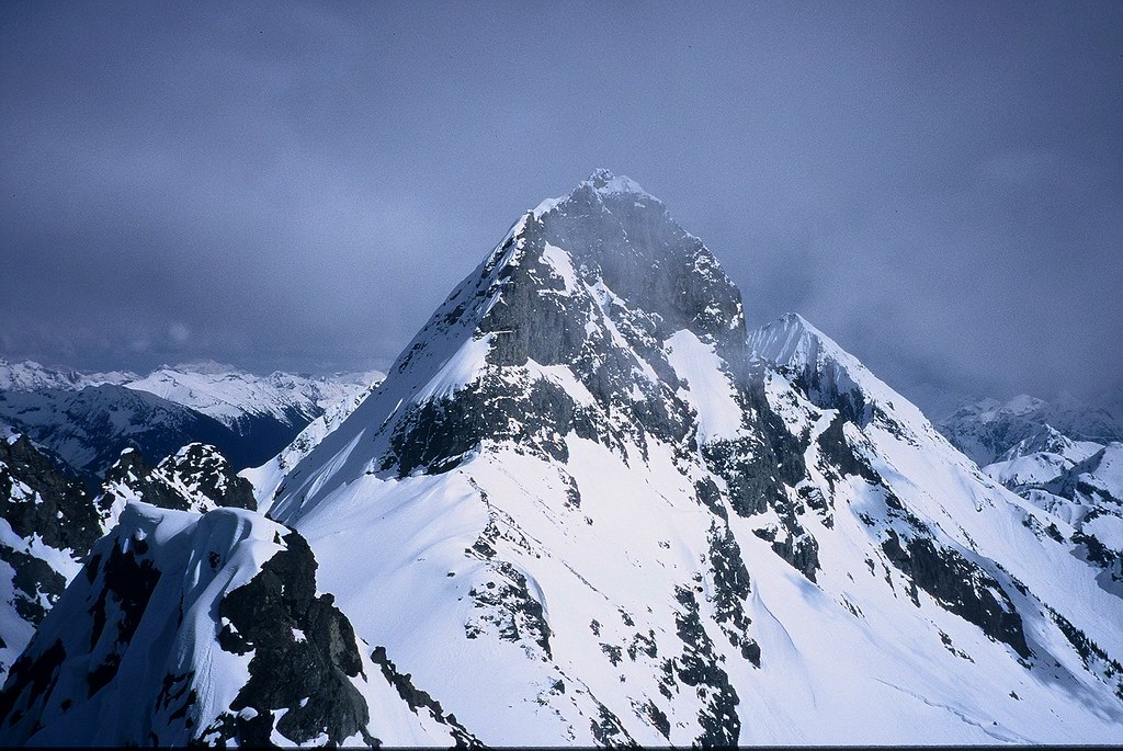
American Border Peak (map) rose 7,998 feet (2,438 metres) on the United States side of the border. Nobody managed to climb it until 1930.
The summit crested just 0.4 miles away from Canada. That didn’t really matter, borders being artificial creations and all. Even so, that placed it within the state of Washington. Specifically it fell within the confines of the Mount Baker Wilderness of the Mount Baker-Snoqualmie National Forest. This height made it the tallest of the four peaks along the ridge. All four broke the 7,000 foot barrier and naturally one had to be the tallest. I declined to make any geopolitical statements based on its altitude relative to the others.
Its isolation and loose terrain made American Border Peak a challenging climb for most people. It didn’t have defined trails to the summit either. That left climbers on their own to find their way across unstable debris. Many waited until springtime when ice and snow locked shifting rocks into place. One doesn’t ordinarily think of snow providing more traction than stone although this particular peak suggested an exception.
Canadian Border Peak

A similar situation appeared on Canadian Border Peak (map), rising 2,291 metres (7,516 feet) in British Columbia. Noticed that I switched to metric for the elevation. We crossed the border into Canada so it seemed appropriate to use the proper unit of measurement that applied there. I like to pander to the local population. Bivouac.com described it as “a sharp pointed horn of mediocre rock.”
Canadians had it a bit easier on their climb to the summit. Logging roads brought climbers further up the hillside. Nonetheless, the underlying rock retained the same characteristics as the American side. They belonged to the same ridge, after all. Here again, a prime time to climb seemed to be springtime with snow on the ground. The first assent happened in 1932.
Leave a Reply