Articles often influence new 12MC articles that I never anticipated originally, as is the case today. Actually, this one come from a comment by “Snabelabe” on All Ways – Every Cardinal Direction. I fixated on a link embedded in the comment, a list of countries and territories by border/area ratio.
I always gravitate towards extremes on these lists, the items at the very top and the very bottom. The bottom listing on this one featured self-contained island nations. Those ratios all equaled zero because they didn’t have any land borders with any other nations. Of course I found them meaningless from an oddity perspective. So then my eyes wandered up the list to the first non-zero value. Sri Lanka had the lowest border-to-area ratio of any nation or territory listed, at 0.0000015 m/km2.
Sri Lanka?
I muttered to myself because I hadn’t yet had my first cup of coffee for the morning. Isn’t Sri Lanka an island? What land border? Yet, according to the list, it abuts another nation for 0.1 km.
The obvious candidate is India. Sri Lanka rests like a little teardrop off of the southeastern tip of the Indian subcontinent. Really, it’s not all that distant when one ponders the situation. Only the Palk Straight separates the Tamil Nadu state of India and the Mannar district of Sri Lanka. That makes the total distance maybe 100km?
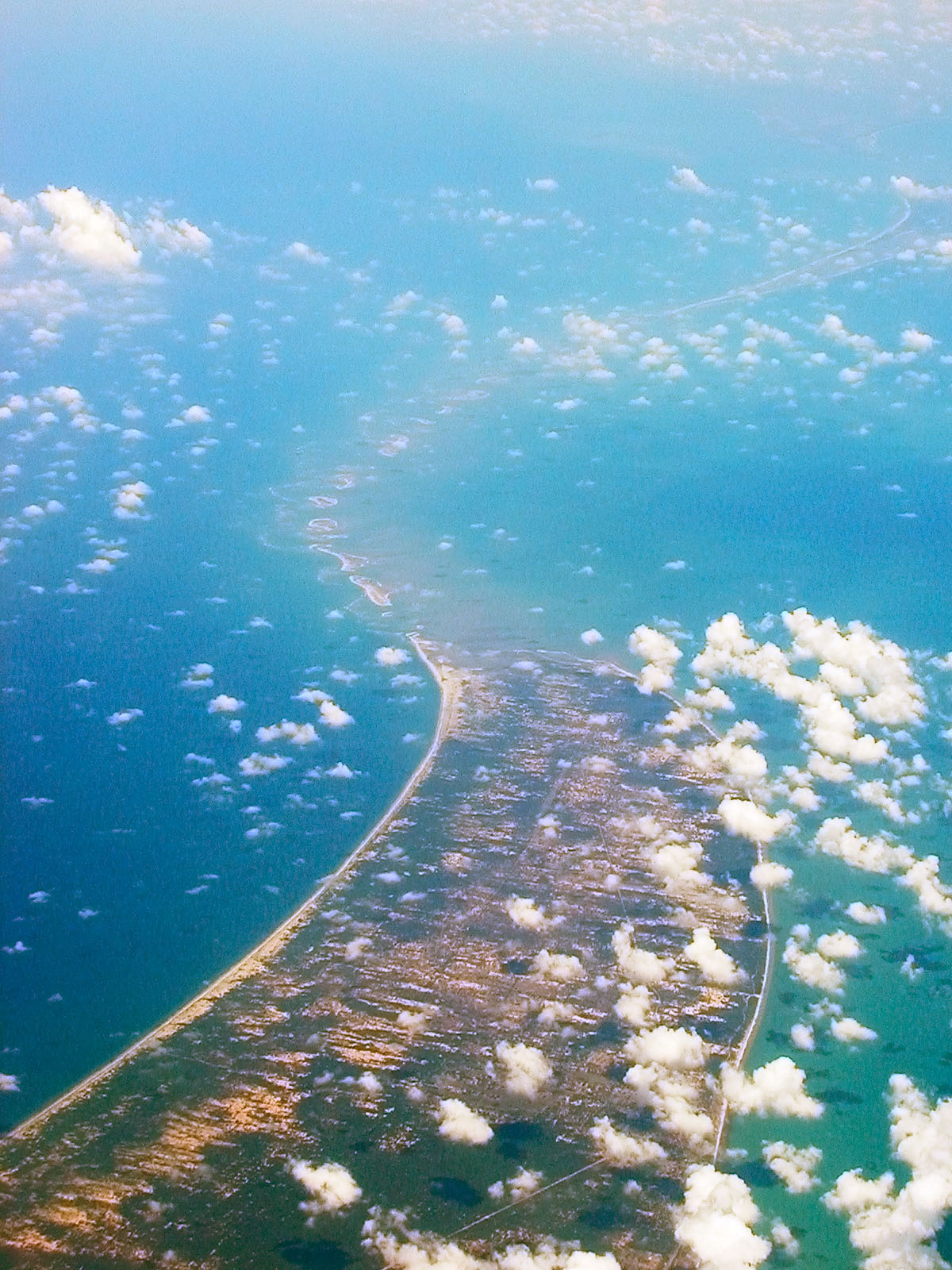
Drill down and one notices other places that come considerably closer. The area known as Rama Setu or Adam’s Bridge comes closest yet. This chain of islets, shoals, sandbars and shallows nearly connects Sri Lanka to India contiguously. Some of the land pokes just high enough above water at a crucial point. Apparently it provides a brief overland boundary between the two nations.
Examining Rama Setu
I guess maybe I must have heard about Rama Setu at one point or another. It seems like the type of geo-oddity that would grab my attention. I must have either overlooked it or forgotten about it. So it was an unexpected joy to either find it or become reacquainted with it when I found that page.
Historic Wonder
Rama Setu used to connect Sri Lanka to India in a literal sense. “It was reportedly passable on foot up to the 15th century until storms deepened the channel: temple records seem to say that Rama’s Bridge was completely above sea level until it broke in a cyclone in 1480 CE.”
The origin of Rama Setu is still a bit of a geological mystery. One set of theories centers on a ridge created as Sri Lanka pulled away from India. Another focuses on longshore drifting and tombolos (I do love a good tombolo!).
A Sanskrit epic ascribed a Hindu religious origin to it. That doesn’t surprise me considering the formation is pretty impressive and well-known historically. Modern-day fringe researchers also postulate that Adam’s Bridge is literally a bridge. They theorize that intelligent yet unknown hands (aliens, lost civilizations, the usual suspects) constructed it. I’m not going to wade into those later waters. If you want to hit the search engines and poke around a bit, go for it.
Modern Inconvenience

However, everyone agrees that Rama Setu impedes commercial shipping albeit they disagree on whether that matters or not. Only the smallest, lowest draft vessels can make it through. Everything else has to go around Sri Lanka. And that’s why the government of India wishes to build the Sethusamudram Shipping Canal.
It seems like a straightforward idea although controversies wrap it from one end to the other. Some object to it from a religious perspective (Rama Setu is a sacred structure to Hindus). Others object from an environmental perspective (it has the potential to alter the alignment of ocean currents in a biologically sensitive area). Still others argue that it doesn’t make sense economically.
Is there truly a land boundary between India and Sri Lanka as claimed? That seems more elusive than I figured. It’s possible that a border may crosses one of the islets or sandbars, either continuously or intermittently. I’m not convinced it’s entirely meaningful.
I wonder if natural forces ever erased any other international borders?

Leave a Reply